


Philip's France and Belgium Road Map
2013
Philip's (Verlag)
978-1-84907-256-4 (ISBN)
Philip's (Verlag)
978-1-84907-256-4 (ISBN)
- Titel erscheint in neuer Auflage
- Artikel merken
Zu diesem Artikel existiert eine Nachauflage
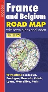
A fully revised new edition of Philip's ultra-clear, double-sided road map covering the whole of France and Belgium, with a comprehensive index and seven town plans.
Philip's France and Belgium Road Map is designed for long-distance driving, and is a convenient size for opening out on a table or in a vehicle.
France and Belgium are shown at 10 km to 1 cm (16 miles to 1 inch), an ideal scale for long-distance driving, with major routes and destinations picked out in bold colours. Toll and pre-pay motorways are clearly shown, along with restricted and unrestricted motorway junctions, service areas and rest areas.
Town plans are provided for Bordeaux, Boulogne, Brussels, Calais, Lyons, Marseilles and Paris.
For holiday planning, the map highlights scenic routes and shows car ferry routes, along with ancient monuments, beaches, castles, cathedrals, national parks, ski resorts, theme parks, world heritage sites, and many other places of interest.
| Erscheint lt. Verlag | 4.2.2013 |
|---|---|
| Verlagsort | London |
| Sprache | englisch |
| Maße | 129 x 243 mm |
| Gewicht | 110 g |
| Themenwelt | Reisen ► Karten / Stadtpläne / Atlanten ► Europa |
| ISBN-10 | 1-84907-256-6 / 1849072566 |
| ISBN-13 | 978-1-84907-256-4 / 9781849072564 |
| Zustand | Neuware |
| Haben Sie eine Frage zum Produkt? |
Mehr entdecken
aus dem Bereich


aus dem Bereich
Buch | Spiralbindung (2024)
Freytag-Berndt und ARTARIA (Verlag)
29,90 €