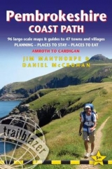
Pembrokeshire Coast Path
Trailblazer Publications (Verlag)
978-1-905864-51-5 (ISBN)
- Titel erscheint in neuer Auflage
- Artikel merken
Practical guidebook to walking the Pembrokeshire Coast Path. The walk follows a National Trail around the coastline in south-west Wales. Includes maps, accommodation, pubs and restaurants, and what to see along the coastal path. 102 maps: 96 large-scale walking maps, 6 town plans, 10 stage with trail profiles and 2 overview. Detailed accommodation: B&Bs, campsites, pubs, hotels, bunkhouses. Where to eat: cafes, pubs and restaurants. Detailed public transport information with frequency of services. Downloadable GPS waypoints. Itineraries for all walkers, whether hiking the entire route or sampling highlights on day walks, weekends or short breaks.
Jim Manthorpe has trekked in many of the world's mountainous regions from Patagonia to the Himalaya and Scandinavia to the Canadian Rockies. Since 1999 he's been a freelance travel writer, photographer and lecturer. He is the author of three other Trailblazer guidebooks: South Downs Way, Scottish Highlands - The Hillwalking Guide, and Tour du Mont Blanc. He has also researched and updated numerous other Trailblazer titles. Jim lived for seven years on the west coast of Scotland in Knoydart, the remotest inhabited place in mainland Britain. As well as writing guidebooks Jim works as a wildlife photographer and film-maker.
INTRODUCTION Pembrokeshire Coast Path History 9 - How difficult is the path? 10 How long do you need? 12 - When to go 13 PART 1: PLANNING YOUR WALK Practical information for the walker Route finding 17 - Accommodation 18 - Food and drink 21 Money 23 - Information for foreign visitors 24 - Other services 25 Walking companies 26 - Disabled access 28 Budgeting 29 Itineraries Village and town facilities 30 - Suggested itineraries 32 Which direction? 33 - Side trips 33 - Day and weekend walks 35 What to take Keep your luggage light 36 - How to carry it 36 - Footwear 37 Clothes 37 - Toiletries 38 - First-aid kit 38 - General items 39 Camping gear 39 - Money 39 - Maps 39 - Sources of further information 40 - Recommended reading 41 Getting to and from the path National transport 42 - Getting to Britain 43 - Local transport 44 Public transport map 47 PART 2: MINIMUM IMPACT WALKING & OUTDOOR SAFETY Minimum impact walking Economic impact 48 - Environmental impact 49 - Access 57 Outdoor safety Avoidance of hazards 52 - Tide tables 53 - Weather forecasts 54 Blisters 54 - Hypothermia 54 - Hyperthermia 55 PART 3: THE ENVIRONMENT & NATURE Flora and fauna Mammals 56 - Reptiles 57 - Conserving Pembrokeshire 58 Birds 58 - Butterflies 63 - Flowers 64 - Trees 65 PART 4: ROUTE GUIDE AND MAPS Using this guide Trail maps 67 Pembrokeshire Coast Path Kilgetty 68 Kilgetty to Amroth 71 Amroth to Tenby 74 Tenby to Manorbier Bay 85 Manorbier Bay to Freshwater East 92 Freshwater East to Broad Haven 92 Broad Haven to Merrion via Stack Rocks 96; via Bosherston 98 Merrion to Angle 102 Angle to Pembroke 108 The Daugleddau and Landsker Borderlands 118 Pembroke to Milford Haven 120 Milford Haven to Dale 130 Dale to Musselwick Sands 140 Musselwick Sands to Broad Haven 146 Broad Haven to Newgale 152 Newgale to Caerfai Bay 156 Caerfai Bay to Whitesands Bay 167 Whitesands Bay to Trefin 170 Trefin to Pwll Deri 180 Pwll Deri to Fishguard 184 Fishguard to Newport 192 A walk in the Preseli Hills 202 Newport to St Dogmaels 204 Cardigan 213 APPENDICES GPS waypoints 216 Map key 219 Taking a dog along the path 220 INDEX 222 OVERVIEW MAPS & PROFILES 226
| Erscheint lt. Verlag | 5.3.2013 |
|---|---|
| Verlagsort | Hindhead, Surrey |
| Sprache | englisch |
| Themenwelt | Sachbuch/Ratgeber ► Sport |
| Reiseführer ► Europa ► Großbritannien | |
| ISBN-10 | 1-905864-51-5 / 1905864515 |
| ISBN-13 | 978-1-905864-51-5 / 9781905864515 |
| Zustand | Neuware |
| Haben Sie eine Frage zum Produkt? |
aus dem Bereich


