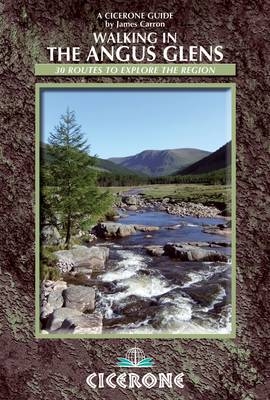
Walking in the Angus Glens
Cicerone Press (Verlag)
978-1-85284-698-5 (ISBN)
- Titel ist leider vergriffen;
keine Neuauflage - Artikel merken
A guidebook to 30 walks in five beautiful glens located south of the Cairngorms National Park in north-east Scotland. The routes described comprise of 26 circular walks arranged by glen - Isla, Prosen, Clova, Lethnot and Esk - and a final, sixth section describing 4 linear walks along the historic Mounth Roads that cross between the glens.
The detailed routes climb Munros including Mount Keen and give lesser-known ascents such as Badandun Hill. From the forested Glen Doll to the rugged bowl of Loch Wharral and the remote reaches of Glen Lethnot, the Angus Glens offer a wide range of walking. Accessible from Dundee and the nearby Angus towns of Brechin and Forfar, the combination of Glens makes a rich, remote landscape.
Walks range from 6 to 25km in length, illustrated with OS 1:50,000 mapping and colour photographs. A wealth of background history, geography and wildlife information are included. Contact details are also given for each area so that readers can check on the access situation before they set out.
Based in Dundee, James Carron holds an enduring love for the Angus Glens. He also makes regular forays overseas and adores hiking in Eastern Europe. A freelance writer specialising in outdoor pursuits, he has written several walking guidebooks and is a regular contributor to outdoor magazines.
Introduction
Landscape
Wildlife
Plants and flowers
Weather
Heritage paths and history
Hill tables
How to use this guide
Planning and preparation
Essential equipment
First aid
Access points and accommodation
Public transport
Access rights and responsibilities
Glen Isla
Walk 1 Monega Hill, Glas Maol, Creag Leacach and Monamenach
Walk 2 Badandun Hill
Walk 3 Mount Blair
Walk 4 Mealna Letter
Walk 5 Craigie Thieves
Walk 6 Corwharn and Milldewan Hill
Walk 7 Craigie Law and Crock
Glen Prosen
Walk 8 Tulloch Hill, The Goal and Hill of Couternach
Walk 9 Cat Law and Long Goat
Walk 10 Knachly and Hill of Spott
Walk 11 Hill of Strone and Driesh
Glen Clova
Walk 12 Broad Cairn and Cairn Bannoch
Walk 13 Tolmount and Tom Buidhe
Walk 14 Driesh and Mayar
Walk 15 Cairn Broadlands and Craig Mellon
Walk 16 Ferrowie and Lair of Aldararie
Walk 17 Ben Tirran
Walk 18 Green Hill, Boustie Ley and Ben Reid
Walk 19 Dog Hillock, Finbracks and Manywee
Glen Lethnot
Walk 20 Hill of Glansie
Walk 21 Tamhilt and Hill of Mondurran
Walk 22 Hill of Wirren and East Wirren
Glen Esk
Walk 23 Mount Battock and Mount Een
Walk 24 Hill of Cat and Hill of Gairney
Walk 25 Mount Keen
Walk 26 Craig Maskeldie and Hunt Hill
Mounth Roads
Walk 27 Capel Mounth
Walk 28 Tolmounth
Walk 29 Firmounth
Walk 30 Mounth
Appendix A Route summary table
Appendix B Useful contacts
| Erscheint lt. Verlag | 1.11.2013 |
|---|---|
| Zusatzinfo | 90 colour photos and 30 OS maps |
| Verlagsort | Kendal |
| Sprache | englisch |
| Maße | 116 x 172 mm |
| Gewicht | 220 g |
| Themenwelt | Sachbuch/Ratgeber ► Sport |
| Reiseführer ► Europa ► Großbritannien | |
| Reiseführer ► Europa ► Schottland | |
| ISBN-10 | 1-85284-698-4 / 1852846984 |
| ISBN-13 | 978-1-85284-698-5 / 9781852846985 |
| Zustand | Neuware |
| Haben Sie eine Frage zum Produkt? |
aus dem Bereich


