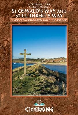
St Oswald's Way and St Cuthbert's Way
Cicerone Press (Verlag)
978-1-85284-669-5 (ISBN)
- Titel ist leider vergriffen;
keine Neuauflage - Artikel merken
In easy stages, this guide describes two long-distance trails through the unspoilt scenery of Northumberland and the Borders. St Oswald's Way begins at Heavenfield and its 97 miles take in rolling farmland before reaching the coast's vast sandy beaches. The 62-mile St Cuthbert's Way, beginning at Melrose, crosses the rugged crags and heather moorland of the Cheviot Hills. Both trails pass through Northumberland National Park to converge on the atmospheric Holy Island - a crucible of Christianity in Britain, and a site of pilgrimage even today. Each can be walked within a week. The guidebook also offers information about the rolling dunes and tidal flats that make up the Northumberland Coast Path. From Cresswell to Berwick (64 miles), this trail covers the entire length of the Northumberland Coast AONB. The variety of scenery, a rich history including Iron Age forts, medieval abbeys and impressive castles, as well as plentiful local wildlife, make Northumberland and the Borders one of Britain's most beautiful corners to explore on foot.
Rudolf Abraham is an award-winning writer and photographer whose love of travel and remote places has taken him from the Balkans to eastern Turkey, Central Asia and Patagonia. Guilty for many years of travelling straight through Northumberland en route to the Highlands, he finally stopped to spend time here in 2008 - and has been returning to his favourite corner of Britain ever since.
Map key
Overview map
Introduction
Geology
Weather
Wildlife and plants
Northumberland National Park
Northumberland Coast AONB
Eildon and Leaderfoot NSA
History and heritage
Pronunciation and glossary
Transport
Accommodation
About the routes
When to go
What to take
Waymarking and access
Maps
Hill and coastal safety
Emergencies
Using this guide
St Oswald's Way
Stage 1 Heavenfield to Kirkwhelpington
Stage 2 Kirkwhelpington to Rothbury
Stage 3 Rothbury to Warkworth
Stage 4 Warkworth to Craster
Stage 5 Craster to Bamburgh
Stage 6 Bamburgh to Fenwick/West Mains
Stage 7 Fenwick/West Mains to Holy Island
Stage 8 Holy Island to Berwick-upon-Tweed
St Cuthbert's Way
Stage 1 Melrose to Jedburgh
Stage 2 Jedburgh to Kirk Yetholm
Stage 3 Kirk Yetholm to Wooler
Stage 4 Wooler to Fenwick/West Mains
(For Stages 5 and 6 see St Oswald's Way Stages 7 and 8)
Appendix A Northumberland Coast Path
Appendix B Route summary table
Appendix C Accommodation
Appendix D Useful contacts
Appendix E Further reading
| Erscheint lt. Verlag | 14.2.2013 |
|---|---|
| Zusatzinfo | 90 colour photos and over 50 maps |
| Verlagsort | Kendal |
| Sprache | englisch |
| Maße | 116 x 172 mm |
| Gewicht | 230 g |
| Themenwelt | Sachbuch/Ratgeber ► Sport |
| Reiseführer ► Europa ► Großbritannien | |
| ISBN-10 | 1-85284-669-0 / 1852846690 |
| ISBN-13 | 978-1-85284-669-5 / 9781852846695 |
| Zustand | Neuware |
| Informationen gemäß Produktsicherheitsverordnung (GPSR) | |
| Haben Sie eine Frage zum Produkt? |
aus dem Bereich


