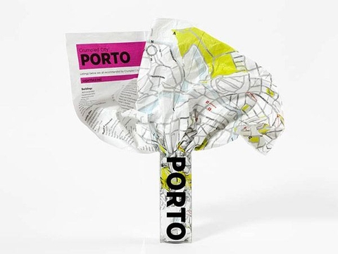
Porto Crumpled City Map
Seiten
2012
Palomar (Verlag)
978-88-97487-26-5 (ISBN)
Palomar (Verlag)
978-88-97487-26-5 (ISBN)
- Keine Verlagsinformationen verfügbar
- Artikel merken
These are pretty much the coolest maps ever, unlike traditional paper maps which can be awkward to deal with, the Porto Crumpled City Map can be easily crammed into your pocket or backpack without having to worry about refolding it along the original creases.
Moreover, the map is printed on special technological material that makes it the lightest and most resistant map on the market, as well as 100% waterproof.
The map provides details about a large part of the city, including streets, monuments, museums, art galleries and much more, it also includes a sightseeing index and a list of unique "Soulsights".
- Crumple it before use!
- The map includes all the most important information about Porto as well as a list "SoulSights".
- It just takes 2 seconds to open and close this innovative soft map.
- Weighing only 20 grams, it is super resistant and 100% waterproof.
The map uncrumples to around 87 x 58cm.
| Erscheint lt. Verlag | 28.9.2012 |
|---|---|
| Reihe/Serie | Crumpled City Maps |
| Zusatzinfo | 1 Illustrations, unspecified |
| Verlagsort | Firenze |
| Sprache | englisch |
| Maße | 116 x 152 mm |
| Gewicht | 35 g |
| Themenwelt | Reisen ► Karten / Stadtpläne / Atlanten ► Europa |
| Reisen ► Karten / Stadtpläne / Atlanten ► Welt / Arktis / Antarktis | |
| ISBN-10 | 88-97487-26-2 / 8897487262 |
| ISBN-13 | 978-88-97487-26-5 / 9788897487265 |
| Zustand | Neuware |
| Haben Sie eine Frage zum Produkt? |
Mehr entdecken
aus dem Bereich
aus dem Bereich
Karte (gefalzt) (2023)
Freytag-Berndt und ARTARIA (Verlag)
12,90 €
Straßen- und Freizeitkarte 1:250.000
Karte (gefalzt) (2023)
Freytag-Berndt und ARTARIA (Verlag)
12,90 €
Östersund
Karte (gefalzt) (2023)
Freytag-Berndt und ARTARIA (Verlag)
12,90 €


