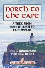
North to the Cape
Cicerone Press (Verlag)
978-1-85284-285-7 (ISBN)
- Titel erscheint in neuer Auflage
- Artikel merken
A guide to Scotland's 200-mile, 326km backpacking trekking route through the West Highlands from Fort William to Cape Wrath, for the experienced walker. This is a glorious long-distance walk. Described as a quintessential backpacking walk it is a challenging route for the experienced walker. The authors had six main criteria in mind: a variety of scenery, no long hauls over featureless terrain, use of designated paths, interesting geography, no high peaks to climb and a good day's walk every day with accommodation at the end. The route is split into 21 stages, many with an easier bad-weather alternative. The guide includes full information, including details of accommodation and advice on where to purchase provisions as you go along.
Denis Brook trained as an electrical engineer but a lifelong passion for the mountains has lead him to the Himalayas, the Andes and East Africa. He as also walked extensively in the northern UK, Pyrenees and Alps. Phil Hinchliffe as walked extensively in the U.K. as well as trekking in the mountains of Norway, the Himalaya, Peruvian Andes and East Africa, making several high-altitude ascents. Having travelled the world, the Western Highlands of Scotland and, particularly, the Far West have become an abiding interest.
WALK STAGES
1. Fort William to Head of Loch Eil (15.5km/9.6 miles)
In and around Fort William
2. Head of Loch Eil to Strathan (16km/9.9 miles)
Variant - Glenfinnan to Strathan (14.5km/9 miles)
Midges, clegs, ticks and flies
3. Strathan to GR884976 (R. Carnach) (17km/10.5 miles)
4. GR884976 to Kinloch Hourn (20km/12.4 miles)
The Caledonian Canal
5. Kinloch Hourn to Shiel Bridge (15.5km/9.6 miles)
Variant - Kinloch Hourn to Shiel Bridge (20.3km/12.6 miles)
6. Shiel Bridge to Killilan (22.5km/14 miles)
The Bagpipes
7. Killilan to Strathcarron (16.5km/10.2 miles)
8. Strathcarron to Achnashellach Station (10.5km/6.5 miles)
Variant - Warning Glen Carron/Strathcarron
Bothies and the MBA
9. Achnashellach Station to Kinlochewe (17km/10.5 miles)
Variant - Achnashellach Station to Coulin (8km/5 miles)
Military Roads
10. Kinlochewe to Loch an Nid (17.1km/10.6 miles)
Variant - Kinlochewe to Lochan Fada (10.4km/6.5 miles)
Prince Charles Edward Louis Philip Casimir Stuart
11. Loch an Nid to Corrie Hallie (Dundonnell) 13km/8.1 miles)
Haggis, Neeps-an' tatties
12. Corrie Hallie to Inverlael (Ullapool) (10.2km/6.3 miles)
Variant - Corrie Hallie to Ullapool (9.5km/5.9 miles)
Ullapool
13. Inverlael to Knockdamph (16.8km/10.4 miles)
Variant - Ullapool to Knockdamph (18.2k/11.3 miles)
Calmac
14. Knockdamph to Oykel Bridge (13km/8.1 miles)
15. Oykel Bridge to Loch Ailsh (13.1km/8.1 miles)
Crofts and Clearances
16. Loch Ailsh to Inchnadamph (16km/9.9 miles)
Variant - Loch Ailsh to Eas a Chùal Aluinn (21.2km/13.1 miles)
Tartan
17. Inchnadamph to Kylesku (18.2km/11.3 miles)
Munro, Corbett and Donald
18. Kylesku to Achfary (13.5km/8.4 miles)
Naismith and Tranter
19. Achfary to Rhiconich (20km/12.4 miles)
Variant - Achfary to Arkle (7.3km/4.5 miles)
Whisky
20. Rhiconich to Blairmore (12km/7.4 miles)
21. Blairmore to Cape Wrath (19km/11.8 miles)
Cape Wrath
| Erscheint lt. Verlag | 15.2.2011 |
|---|---|
| Verlagsort | Kendal |
| Sprache | englisch |
| Maße | 116 x 172 mm |
| Gewicht | 230 g |
| Themenwelt | Sachbuch/Ratgeber ► Sport |
| Reiseführer ► Europa ► Großbritannien | |
| Reiseführer ► Europa ► Schottland | |
| ISBN-10 | 1-85284-285-7 / 1852842857 |
| ISBN-13 | 978-1-85284-285-7 / 9781852842857 |
| Zustand | Neuware |
| Haben Sie eine Frage zum Produkt? |
aus dem Bereich


