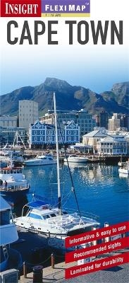
Insight Guides Flexi Map Cape Town
Seiten
2012
|
3rd Revised edition
Insight Guides (Verlag)
978-1-78005-416-2 (ISBN)
Insight Guides (Verlag)
978-1-78005-416-2 (ISBN)
- Titel ist leider vergriffen;
keine Neuauflage - Artikel merken
Includes 5 maps of Capetown. It covers all the major tourists areas, with points of interest and general tourist information marked and indexed by category - streets, shopping, public buildings, parks and hotels. It provides an overview of the Cape Peninsula and includes an inset map of Robben Island, and also a map of Cape Town Environs.
Fleximap Cape Town includes 5 maps. The main map is a detailed street map (1:17 000) including all the major tourists areas, with points of interest and general tourist information clearly marked and indexed by category - streets, shopping, public buildings, parks and hotels. A larger scale map (1:165 000) gives a handy overview of the Cape Peninsula and includes an inset map of Robben Island, there is also a map of Cape Town Environs (1:2 000 000), these maps are indexed for points of interest, streets and places. The back cover is dedicated to the Metrorail network.
In addition to the mapping, Fleximap Cape Town also includes a list - with descriptions and some photographs - of 31 recommended sights, divided by theme and linked to the mapping by numbered markers. There is also a handy information section with concise details on getting around the city, tourist offices, money, tipping, opening times, public holidays, telecommunications, emergency telephone numbers and climate.
| Erscheint lt. Verlag | 3.9.2012 |
|---|---|
| Reihe/Serie | Insight Guides Flexi Maps |
| Verlagsort | London |
| Sprache | englisch |
| Themenwelt | Reisen ► Karten / Stadtpläne / Atlanten ► Afrika |
| ISBN-10 | 1-78005-416-5 / 1780054165 |
| ISBN-13 | 978-1-78005-416-2 / 9781780054162 |
| Zustand | Neuware |
| Haben Sie eine Frage zum Produkt? |
Mehr entdecken
aus dem Bereich
aus dem Bereich
Karte (gefalzt) (2024)
Freytag-Berndt und ARTARIA (Verlag)
12,90 €
Karte (gefalzt) (2023)
Freytag-Berndt und ARTARIA (Verlag)
12,90 €
reiß- und wasserfest (world mapping project)
Karte (gefalzt) (2024)
Reise Know-How (Verlag)
14,00 €


