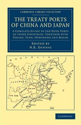
The Treaty Ports of China and Japan
A Complete Guide to the Open Ports of those Countries, together with Peking, Yedo, Hongkong and Macao
Seiten
2012
Cambridge University Press (Verlag)
978-1-108-04590-2 (ISBN)
Cambridge University Press (Verlag)
978-1-108-04590-2 (ISBN)
This guide to China and Japan, edited by Nicholas Belfield Dennys (?1813–99) was one of the first directories of its type to be publicly available. Typeset and engraved in China, it was published in Hong Kong and London in 1867, and provides comprehensive information on the key treaty ports.
As trade between the East and the West grew in the mid-nineteenth century, increasing numbers of Westerners travelled to China and Japan, and in 1867 this guide to the key port cities such as Hong Kong and Nagasaki was published in both Hong Kong and London. Its editor, Nicholas Belfield Dennys (?1813–99) claimed it was the first such comprehensive handbook printed for public distribution. Intended for visitors and new residents, the guide was originally typeset in China, allowing place names and other words to be printed in Chinese characters. The specially commissioned maps were also engraved in China. The book includes physical descriptions and brief histories of over twenty cities, details of schools and libraries, population statistics and much practical information, as well as a list of other publications on China and Japan. It is a valuable historical source on East Asia during a period of rapid change.
As trade between the East and the West grew in the mid-nineteenth century, increasing numbers of Westerners travelled to China and Japan, and in 1867 this guide to the key port cities such as Hong Kong and Nagasaki was published in both Hong Kong and London. Its editor, Nicholas Belfield Dennys (?1813–99) claimed it was the first such comprehensive handbook printed for public distribution. Intended for visitors and new residents, the guide was originally typeset in China, allowing place names and other words to be printed in Chinese characters. The specially commissioned maps were also engraved in China. The book includes physical descriptions and brief histories of over twenty cities, details of schools and libraries, population statistics and much practical information, as well as a list of other publications on China and Japan. It is a valuable historical source on East Asia during a period of rapid change.
Part I. China: Preface; 1. Hongkong; 2. Canton; 3. Macao; 4. Swatow; 5. Amoy; 6. Foochow; 7. Formosa; 8. Takow; 9. Taiwanfoo; 10. Tamsui; 11. Kelung; 12. Ningpo; 13. Shanghae; 14. Yang-tz' and River Ports; 15. Chinkiang; 16. Nanking; 17. Kiu-kiang; 18. Hankow; 19. Chefoo; 20. Taku; 21. Tientsing; 22. Peking; 23. Newchwang; Part II. Japan: 24. Japan; 25. Nagasaki; 26. Yokohama; 27. Yedo; 28. Hakodadi; 29. Hiogo; Index; Appendix.
| Erscheint lt. Verlag | 26.4.2012 |
|---|---|
| Reihe/Serie | Cambridge Library Collection - East and South-East Asian History |
| Mitarbeit |
Zusammenstellung: Nicholas Belfield Dennys |
| Zusatzinfo | 29 Maps |
| Verlagsort | Cambridge |
| Sprache | englisch |
| Maße | 140 x 216 mm |
| Gewicht | 1080 g |
| Themenwelt | Reiseführer ► Asien ► China |
| Reiseführer ► Asien ► Japan | |
| Geschichte ► Allgemeine Geschichte ► Neuzeit (bis 1918) | |
| Geisteswissenschaften ► Geschichte ► Regional- / Ländergeschichte | |
| ISBN-10 | 1-108-04590-1 / 1108045901 |
| ISBN-13 | 978-1-108-04590-2 / 9781108045902 |
| Zustand | Neuware |
| Haben Sie eine Frage zum Produkt? |
Mehr entdecken
aus dem Bereich
aus dem Bereich
80 unvergessliche Reisen auf allen Kontinenten
Buch | Hardcover (2024)
DK Reiseführer (Verlag)
39,95 €


