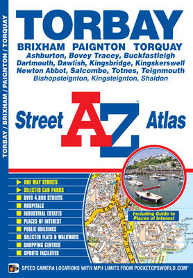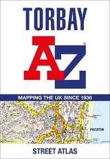
Torbay A-Z Street Atlas
Seiten
2019
|
New Sixth edition
Geographers' A-Z Map Co Ltd (Verlag)
978-1-84348-833-0 (ISBN)
Geographers' A-Z Map Co Ltd (Verlag)
978-1-84348-833-0 (ISBN)
- Titel ist leider vergriffen;
keine Neuauflage - Artikel merken
Zu diesem Artikel existiert eine Nachauflage
This A-Z map of Torbay is a full colour street atlas and for the first time, features a places of interest guide. This publication has 34 pages of street mapping, which extends to cover:
•Brixham
Paignton
Torquay
Kingskerswell
Newton Abbot
Bovey Tracey
Teignmouth
Dawlish
Ashburton
Buckfastleigh
Totnes
Kingsbridge
Salcombe
Dartmouth
In addition, there are insets of: Bishopsteignton, Ipplepen, Stoke Gabriel and a large scale town centre map of Dartmouth.
Postcode districts, one-way streets, Park and Ride sites, safety camera locations with their maximum speed and Dartmoor National Park boundary are featured on the mapping.
The Places of Interest Guide is both informative and helpful with information about:
•Tourist Information Centres
•Boat trips
•Selected places of interest
The index section lists streets, selected flats, walkways and places of interest, place, area and station names, hospitals and hospices covered by this atlas.
This atlas is ideal, not only for navigation, but for exploring the Torbay area, also known as 'The English Riviera'.
Britain’s leading street map publisher providing cartographic services, digital data products and paper mapping publications (including Street Atlases, Visitors Guides, Great Britain Road Atlases and The Adventure Atlas).
| Erscheint lt. Verlag | 18.2.2019 |
|---|---|
| Sprache | englisch |
| Maße | 149 x 215 mm |
| Gewicht | 110 g |
| Themenwelt | Reisen ► Karten / Stadtpläne / Atlanten ► Europa |
| ISBN-10 | 1-84348-833-7 / 1843488337 |
| ISBN-13 | 978-1-84348-833-0 / 9781843488330 |
| Zustand | Neuware |
| Haben Sie eine Frage zum Produkt? |
Mehr entdecken
aus dem Bereich
aus dem Bereich
Buch | Spiralbindung (2024)
Freytag-Berndt und ARTARIA (Verlag)
29,90 €
Buch | Spiralbindung (2023)
Freytag-Berndt und ARTARIA (Verlag)
36,90 €


