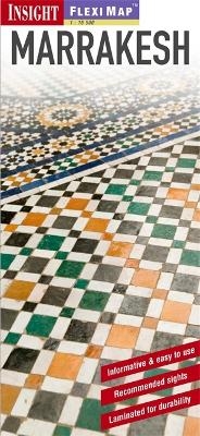
Insight Flexi Map: Marrakesh
Seiten
2012
|
2nd Revised edition
Insight Maps (Verlag)
978-1-78005-411-7 (ISBN)
Insight Maps (Verlag)
978-1-78005-411-7 (ISBN)
- Titel ist leider vergriffen;
keine Neuauflage - Artikel merken
Includes 5 maps of Marrakesh. To help you plan your trip and prioritise the must-see sights, this title includes a list - with descriptions and photographs - of 29 recommended sights in the city and further afield, divided by theme and linked to the mapping by numbered markers.
Fleximap Marrakesh includes 5 maps. The main map (1 : 15 000) shows entire city, with points of interest and general tourist information clearly marked. There is also a detailed map of the city centre (1 : 7 000) to help you find your way around the maze of narrow streets. A useful route planning map of the region around Marrakesh (1 : 900 000) helpsyou to plan trips to the nearby Atlas Mountains as well as into the desert and to the coast. Also included is a map of central Agadir (1 : 15 000), and an overview map (1 : 45 000 000) of the northern half of Africa.
As well as making the map easy to fold and extra-durable, the laminated finish allows you to mark your itinerary on the map and then wipe it off afterwards.
To help you plan your trip and prioritise the must-see sights, Marrakesh also includes a list - with descriptions and photographs - of 29 recommended sights in the city and further afield, divided by theme and linked to the mapping by numbered markers. There is also a handy information section with concise details on getting around the region, tourist offices, money, tipping, opening times, public holidays, telecommunications, emergency telephone numbers, and climate.
| Erscheint lt. Verlag | 1.6.2012 |
|---|---|
| Reihe/Serie | Insight Guides Flexi Maps |
| Sprache | englisch |
| Themenwelt | Reisen ► Karten / Stadtpläne / Atlanten ► Afrika |
| Reisen ► Reiseführer | |
| ISBN-10 | 1-78005-411-4 / 1780054114 |
| ISBN-13 | 978-1-78005-411-7 / 9781780054117 |
| Zustand | Neuware |
| Haben Sie eine Frage zum Produkt? |
Mehr entdecken
aus dem Bereich
aus dem Bereich
Karte (gefalzt) (2024)
Freytag-Berndt und ARTARIA (Verlag)
12,90 €
Karte (gefalzt) (2023)
Freytag-Berndt und ARTARIA (Verlag)
12,90 €
reiß- und wasserfest (world mapping project)
Karte (gefalzt) (2024)
Reise Know-How (Verlag)
14,00 €


