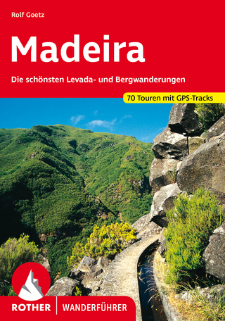
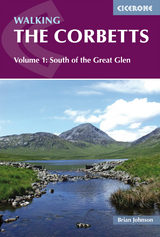
Walking the Corbetts Vol 1 South of the Great Glen
Cicerone Press (Verlag)
978-1-85284-652-7 (ISBN)
A guidebook presenting 95 routes visiting 112 of Scotland’s Corbetts (mountains between 2500 and 2999ft). Covering the area south of the Great Glen, including Arran and Jura, the walks require good fitness and navigation skills plus experience in remote mountainous terrain: while many are straightforward ascents, some involve scrambling and river crossings.
The routes range from 5 to 41km (3–25 miles) and include hikes in the Southern Uplands, Arrochar Alps, Trossachs, Grampians and Cairngorms.
Part of a 2-volume set: an accompanying Cicerone guidebook, Walking the Corbetts Vol 2 North of the Great Glen, is also available
Clear route description illustrated with 1:100,000 mapping
Difficulty notes for each route detailing terrain, challenges and hazards
Information on maps, parking, local bases and facilities
Alphabetical list of the Corbetts
Since taking early retirement from teaching, Brian Johnson has hiked the Pacific Crest Trail three times, completed a 2700-miles walk round Britain, hiked across the Pyrenees three times and completed a 2200-mile cycle tour of Spain and France. He has achieved a single summer compleation of the Munros and has climbed all of the Corbetts.
Preface
Overview maps
Map key
Introduction
What are the Corbetts?
Geology
Human history in the Highlands
The natural environment
Walking the Corbetts
When to go
The terrain
Weather
Access
Mountain bothies
Navigation
Safety
Areas in this guide
Using this guide
1 The Southern Uplands
Route 1 Merrick
Route 2 Shalloch on Minnoch
Route 3 Corserine
Route 4 Cairnsmore of Carsphairn
Route 5 Hart Fell
Route 6 White Coomb
Route 7 Broad Law
2 Arran and Jura
Route 8 Goatfell
Route 9 Beinn Tarsuinn, Caisteal Abhail and Cir Mhor
Route 10 Beinn an Oir
3 West of Loch Lomond (Arrochar Alps)
Route 11 Beinn Bheula
Route 12 Ben Donich and The Brack
Route 13 The Cobbler
Route 14 Beinn Luibhean
Route 15 Beinn an Lochain
Route 16 Stob Coire Creagach (Binnein an Fhidhleir)
Route 17 Meall an Fhudair
4 East of Loch Lomond (The Trossachs)
Route 18 Beinn a' Choin
Route 19 Ben Ledi and Benvane
Route 20 Beinn Each
Route 21 Stob a' Choin
Route 22 Stob Fear-tomhais
Route 23 Meall an t-Seallaidh and Creag MacRanaich
Route 24 Meall na Fearna
Route 25 Creag Uchdag
Route 26 Auchnafree Hill
5 South-West Grampians
Route 27 Beinn a' Bhuiridh
Route 28 Beinn Mhic Mhonaidh
Route 29 Beinn Udlaidh and Beinn Bhreac-liath
Route 30 Beinn Chuirn
Route 31 Beinn Odhar , Beinn Chaorach , Cam Chreag , Beinn nam Fuaran and Beinn a' Chaisteil
6 The Southern Grampians
Route 32 Beinn nan Imirean
Route 33 Meall nan Subh
Route 34 Sron a' Choire Chnapanich and Meall Buidhe
Route 35 Beinn nan Oighreag
Route 36 Meall nam Maigheach
Route 37 Cam Chreag
Route 38 Beinn Dearg
Route 39 Creagan na Beinne
7 The Western Grampians
Route 40 Creach Bheinn
Route 41 Fraochaidh
Route 42 Meall Lighiche
Route 43 Beinn Trilleachan
Route 44 Stob Dubh
Route 45 Beinn Maol Chaluim
Route 46 Beinn Mhic Chasgaig
Route 47 Beinn a' Chrulaiste
Route 48 Garbh Bheinn
Route 49 Mam na Gualainn
Route 50 Glas Bheinn
8 The Central Grampians
Route 51 Leum Uilleim
Route 52 Meall na Meoig of Beinn Pharlagain
Route 53 Stob an Aonaich Mhoir
Route 54 Beinn a' Chuallaich
Route 55 Meall Tairneachan and Farragon Hill
Route 56 Ben Vrackie
Route 57 Ben Vuirich
Route 58 Beinn Mheadhonach
Route 59 Beinn Bhreac
Route 60 An Dun and Maol Creag an Loch (A' Chaoirnich)
Route 61 Meall na Leitreach
Route 62 Beinn Mholach
Route 63 The Sow of Atholl
Route 64 The Fara
9 Badenoch
Route 65 Sgurr Innse and Cruach Innse
Route 66 Beinn Iaruinn
Route 67 Carn Dearg (Glen Roy)
Route 68 Carn Dearg (N of Gleann Eachach) and Carn Dearg (S of Gleann Eachach)
Route 69 Carn a' Chuillinn
Route 70 Gairbeinn
Route 71 Meall na h-Aisre
Route 72 Carn an Fhreiceadain
Route 73 Meallach Mhor
Route 74 Leathad an Taobhain and Carn Dearg Mor
10 The Southern Cairngorms
Route 75 Mount Battock
Route 76 Ben Tirran
Route 77 Monamenach
Route 78 Ben Gulabin
Route 79 Creag nan Gabhar
Route 80 Morrone
Route 81 Sgor Mor
Route 82 Carn na Drochaide
Route 83 Carn Liath and Culardoch
Route 84 Conachcraig
Route 85 Morven
11 The Northern Cairngorms
Route 86 Brown Cow Hill
Route 87 Carn Ealasaid
Route 88 Carn Mor
Route 89 Corryhabbie Hill
Route 90 Ben Rinnes
Route 91 Geal Charn
Route 92 Meall a'Bhuachaille
Route 93 Creag Mhor
Route 94 Geal-charn Mor
Route 95 Carn na Saobhaidhe
Appendix A Alphabetical list of the Corbetts
Appendix B Useful information
| Erscheint lt. Verlag | 11.10.2019 |
|---|---|
| Reihe/Serie | Cicerone guidebooks |
| Zusatzinfo | 90 contour maps and 135 colour photos |
| Verlagsort | Kendal |
| Sprache | englisch |
| Maße | 116 x 172 mm |
| Gewicht | 390 g |
| Themenwelt | Sachbuch/Ratgeber ► Sport |
| Reisen ► Sport- / Aktivreisen ► Europa | |
| ISBN-10 | 1-85284-652-6 / 1852846526 |
| ISBN-13 | 978-1-85284-652-7 / 9781852846527 |
| Zustand | Neuware |
| Haben Sie eine Frage zum Produkt? |
aus dem Bereich