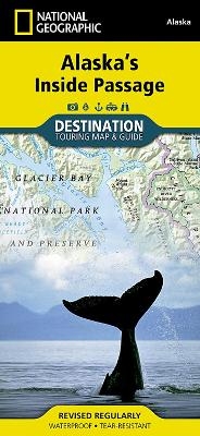
Alaska's Inside Passage
Destination Map
Seiten
2011
National Geographic Maps (Verlag)
978-1-59775-451-4 (ISBN)
National Geographic Maps (Verlag)
978-1-59775-451-4 (ISBN)
- Titel nicht im Sortiment
- Artikel merken
Explore the exhilarating majesty and mystique of Southeast Alaska with National Geographic's Alaska's Inside Passage Destination Map. The Inside Passage is a meandering waterway formed by a myriad of islands that lie between the North Pacific Ocean and the quieter waters along the coast. At its heart is the Tongass National Forest, the largest national forest in the United States which at a staggering 16.8 million acres contains 19 designated wilderness areas and the Admiralty Island and Misty Fiords National Monuments.
Founded in 1915 as the Cartographic Group, the first division of the National Geographic Society, National Geographic Maps has been responsible for illustrating the world around us through the art and science of mapmaking. Today, National Geographic Maps continues this mission by creating the world's best wall maps, recreation maps, atlases, and globes which inspire people to care about and explore their world. All proceeds from the sale of National Geographic maps go to support the Society's non-profit mission to increase global understanding and promote conservation of our planet through exploration, research, and education.
| Verlagsort | Evergreen |
|---|---|
| Sprache | englisch |
| Maße | 108 x 235 mm |
| Gewicht | 93 g |
| Themenwelt | Reisen ► Karten / Stadtpläne / Atlanten ► Nord- / Mittelamerika |
| Reiseführer ► Nord- / Mittelamerika ► USA | |
| ISBN-10 | 1-59775-451-X / 159775451X |
| ISBN-13 | 978-1-59775-451-4 / 9781597754514 |
| Zustand | Neuware |
| Haben Sie eine Frage zum Produkt? |
Mehr entdecken
aus dem Bereich
aus dem Bereich
Karte (gefalzt) (2024)
Michelin Editions des Voyages (Verlag)
11,95 €
Map
Karte (gefalzt) (2024)
Michelin Editions des Voyages (Verlag)
19,95 €


