Street guide Cape Town
2011
|
16th ed
Struik Publishers,South Africa (Verlag)
978-1-77026-282-9 (ISBN)
Struik Publishers,South Africa (Verlag)
978-1-77026-282-9 (ISBN)
- Titel wird leider nicht erscheinen
- Artikel merken
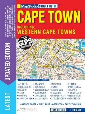
This new edition Cape Town street guide includes new interchange layouts for Hospital bend and Koeberg and includes an extra keyplan indicating major freeway exits. The guide shows GPS co-ordinates for main intersection and includes suburb boundaries. Contains a detailed index to street and complex names, airport maps of OR Thambo, Cape Town International and King Shaka International and detailed wine estate positions with indexes. Detailed street maps of Atlantis, Bredasdorp, Caledon, Ceres, Darling, Franschhoek, Grabouw, Hermanus, Gordon's Bay, Kleinmond, Langebaan, Malmesbury, Montagu, Paarl, Robertson, Saldanha, Somerset West, Stellenbosch, Strand, Swellendam, Tulbagh, Villiersdorp, Wellington and Worcester. These maps indicate positions of police stations, sports venues, schools, municipal buildings, places of interest, historical sites, parks, railway stations, airports and airfields.
| Sprache | englisch |
|---|---|
| Maße | 210 x 297 mm |
| Gewicht | 900 g |
| Themenwelt | Reisen ► Karten / Stadtpläne / Atlanten ► Afrika |
| ISBN-10 | 1-77026-282-2 / 1770262822 |
| ISBN-13 | 978-1-77026-282-9 / 9781770262829 |
| Zustand | Neuware |
| Haben Sie eine Frage zum Produkt? |
Mehr entdecken
aus dem Bereich
aus dem Bereich
Entdeckungsreisen im Land der San: von Gaborone zur größten …
Buch | Softcover (2024)
DuMont Reiseverlag
24,95 €
