Cycling the Pennine Bridleway
Cicerone Press (Verlag)
978-1-85284-655-8 (ISBN)
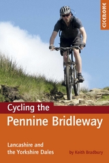
This guidebook covers the northern stages of the Pennine Bridleway, through Lancashire, Yorkshire and Cumbria, a dedicated and waymarked mountain biking and horse-riding trail that opened in 2011. Using part of the Mary Towneley Loop, the route is described for mountain bikers from Summit, just outside Rochdale all the way to Ravenstonedale in Cumbria, in about 176km.
11 circular day mountain bike routes are included for those who do not wish to ride the whole route as a linear trail. It splits the main bridleway into rides of 8 - 16 miles in length.
A grand total of 384km of trail are covered, mapped using OS map extracts and illustrated with profiles, photographed and described in enough detail to suit all levels of navigational ability. Appendices also offer information on local facilities, accommodation, bike shops and other useful contacts for planning your days out or longer trip along the Bridleway, and information provided before each route description includes distance, ascent, grading, estimated time and percentage of route off-road, as well as maps needed and pubs and cafes en route.
Keith Bradbury has many pursuits on his outdoors CV including canoeing, trekking, walking, climbing, caving, cycling and mountain biking. He has been exploring the bridleways of the Lake District and Yorkshire Dales national parks for twenty years and prides himself on his knowledge of them.
Overview map Introduction Where to start? Getting there Who is this guide for? When to go Accommodation Safety How far can I ride in a day? What type of bike will I need? Waymarks and access Using this guide What to take Section 1: The Mary Towneley Loop Summit to Hurstwood (anti-clockwise) Section 2: A linear description of the Pennine Bridleway The Lancashire Link Part 1 Hurstwood to Barnoldswick Part 2 Barnoldswick to Long Preston The Yorkshire Dales Part 1 Long Preston to Horton-in-Ribblesdale Part 2 Horton-in-Ribblesdale to Garsdale Head Part 3 Garsdale Head to Ravenstonedale Section 3: Day loops off the Pennine Bridleway Route 1 The Settle Loop Route 2 Giggleswick, Wharfe and Catrigg Force Route 3 Clapham, Crummack Dale and Feizor Route 4 Horton-in-Ribblesdale, Helwith Bridge and Sulber Nick Route 5 Ribblehead to Ling Gill and Horton-in-Ribblesdale Route 6 Ribblehead to Dentdale, via The Craven Way Route 7 Cam High Road and The Ribble Way Route 8 Arten Gill, Dent Head Viaduct and the Driving Road Route 9 Garsdale to Dentdale, via Dandra Garth Route 10 Lady Anne’s Highway Route 11 Ravenstonedale, Pendragon Castle & High Dolphinsty Appendices Appendix A Route summary tables Appendix B Local facilities Appendix C Useful contacts Appendix D Accommodation Appendix E Bike shops
| Erscheint lt. Verlag | 16.2.2017 |
|---|---|
| Reihe/Serie | Cicerone guidebooks |
| Zusatzinfo | 50 colour maps and profiles and 85 colour photos |
| Verlagsort | Kendal |
| Sprache | englisch |
| Maße | 116 x 172 mm |
| Gewicht | 270 g |
| Themenwelt | Sachbuch/Ratgeber ► Sport ► Motor- / Rad- / Flugsport |
| Reiseführer ► Europa ► Großbritannien | |
| Reisen ► Sport- / Aktivreisen ► Europa | |
| ISBN-10 | 1-85284-655-0 / 1852846550 |
| ISBN-13 | 978-1-85284-655-8 / 9781852846558 |
| Zustand | Neuware |
| Informationen gemäß Produktsicherheitsverordnung (GPSR) | |
| Haben Sie eine Frage zum Produkt? |
aus dem Bereich