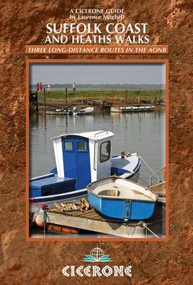
Suffolk Coast and Heaths Walks
Cicerone Press (Verlag)
978-1-85284-654-1 (ISBN)
- Titel ist leider vergriffen;
keine Neuauflage - Artikel merken
The three long-distance walks described in this book - the Suffolk Coast Path, the Stour and Orwell Walk and the Sandlings Walk - link together to provide a comprehensive and varied circuit of the entire Suffolk Heritage Coast. The Suffolk Coast Path stretches along the coast between Lowestoft and Landguard Fort, close to Felixstowe in the south, a total distance of 55-60 miles (89-97km) depending on whether beach walking or inland options are followed. The Stour and Orwell Walk continues where the Suffolk Coast Path ends, starting at Landguard Point threading for 43 mile (69km) around the estuaries of the Stour and Orwell rivers to finish at Cattawade, close to the Essex border. The Sandlings Walk (59 miles/94.5km) explores the heathland region that lies immediately inland from the Suffolk coast. With the exception of the first stage, between Ipswich and Woodbridge, the route of the Sandlings Walk lies entirely within the confines of the Suffolk Coast and Heaths AONB. With a unique landscape of cliffs, marshes, dunes and shingle beaches, and rare plants and birdlife galore, there is much to attract anyone seeking interesting day walks or longer multi-day itineraries.
Laurence Mitchell worked as a geography teacher for many years before becoming a travel writer and photographer. He is especially interested in off-the-beaten-track locations and has written guides to Serbia and Kyrgyzstan. When not abroad he likes to explore his own backyard of Norfolk and Suffolk. He has contributed to many travel anthologies and is a member of the British Guild of Travel Writers.
OS map key
Overview map
Foreword by Nick Collinson, Suffolk Coast and Heaths AONB Manager
Introduction
Three long-distance walks
Geology
History of the landscape
Wildlife and flowers
Culture and heritage
Getting there and back
Ferries
When to go
What to take
Food and accommodation
Waymarks and access
Safety
Maps
Using this guide
Suffolk Coastal Path
Stage 1 Lowestoft to Covehithe
Stage 2 Covehithe to Southwold
Stage 3 Southwold to Dunwich
Stage 4 Dunwich to Thorpeness
Stage 5 Thorpeness to Snape Maltings
Stage 6 Snape Maltings to Chillesford
Stage 7 Chillesford to Shingle Street
Stage 8 Shingle Street to Landguard Fort, Felixstowe
Stour and Orwell Walk
Stage 1 Landguard Fort, Felixstowe to Nacton
Stage 2 Nacton to Orwell Bridge or Ipswich
Stage 3 Orwell Bridge to Pin Mill
Stage 4 Pin Mill to Lower Holbrook
Stage 5 Lower Holbrook to Cattawade
Sandlings Walk
Stage 1 Ipswich to Woodbridge via Martlesham Heath
Stage 2 Woodbridge to Sutton Common
Stage 3 Sutton Common to Butley via Rendlesham Forest
Stage 4 Butley to Snape Maltings via Tunstall Forest
Stage 5 Snape Maltings to Thorpeness
Stage 7 Dunwich Heath to Southwold
Appendix A Route summary table
Appendix B Useful contacts
Appendix C Further reading
| Erscheint lt. Verlag | 10.2.2012 |
|---|---|
| Zusatzinfo | 30 OS map extracts and over 70 colour photos |
| Verlagsort | Kendal |
| Sprache | englisch |
| Maße | 116 x 172 mm |
| Gewicht | 220 g |
| Themenwelt | Sachbuch/Ratgeber ► Sport |
| Reiseführer ► Europa ► Großbritannien | |
| ISBN-10 | 1-85284-654-2 / 1852846542 |
| ISBN-13 | 978-1-85284-654-1 / 9781852846541 |
| Zustand | Neuware |
| Haben Sie eine Frage zum Produkt? |
aus dem Bereich


