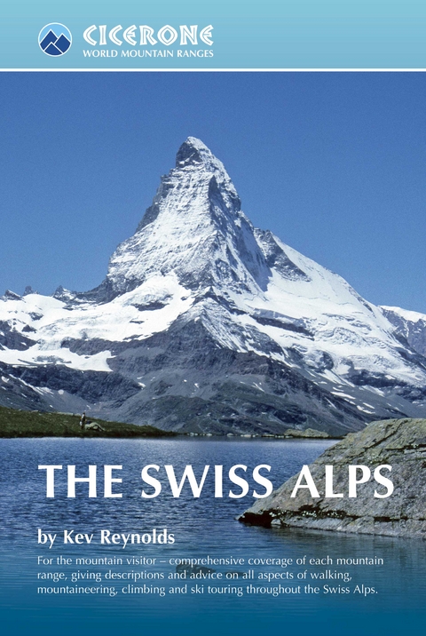
The Swiss Alps
Cicerone Press (Verlag)
978-1-85284-465-3 (ISBN)
This comprehensive book is an excellent planning resource for those who wish to venture into the Swiss Alps. Whether you are planning a walk, scramble, climb or ski tour this larger format guide describes each mountain area throughout Switzerland - the peaks, passes, valleys and bases - to help readers identify the best destinations for their chosen mountain activity.
Dozens of individual valleys are described, together with the mountains that wall them, with recommendations given for their finest walks, treks and climbs. Working eastwards across the country, this guide is divided into seven chapters: Chablais Alps, Pennine Alp, Lepontine and Adula Alps, Bernina, Bregaglia and Albula Alps, Bernese Alps, Central Swiss Alps and the Silvretta and Ratikon Alps, each devoted to a specific range or group of connecting ranges.
However, this is not a route guide and detailed descriptions are not provided. The aim of the book is to inspire as well as inform; to show first-time visitors just what the Swiss Alps have to offer and provide a new perspective for those who have been before.
Kev Reynolds is a freelance writer, photojournalist and lecturer. A prolific compiler of guidebooks, his first title for Cicerone appeared in 1978; he has since produced 27 other Cicerone titles, with more being researched. A member of the Outdoor Writers Guild, the Alpine Club and Austrian Alpine Club, his passion for mountains and the countryside remains undiminished.
Overview Map
Introduction
About this Book
The Mountain Ranges
Practicalities
When to Go
Weather
Getting There
Getting Around
Accommodation
Mountain Huts
Maps and Guidebooks
Health Considerations
The Mountains
Mountain Activities
Safety Dos and Don'ts
Mountain Rescue
Plant and Animal Life
Environmental Ethics
Information at a Glance
Chapter 1: Chablais Alps
1:1 Val de Morgins
1:2 Val d'Illiez
1:3 Vallon de Susanfe
1:4 Rhône Valley Approaches
1:5 Vall&##xe9;e du Trient
Access, Bases, Maps and Guides
Chapter 2: Pennine Alps
2:1 Val Ferret
2:2 Val d'Entremont
2:3 Val de Bagnes
2:4 Val de Nendaz
2:5 Val d'H&##xe9;r&##xe9;mence
2:6 Val d'H&##xe9;rens
2:7 Val de Moiry
2:8 Val d'Anniviers
2:9 Turtmanntal
2:10 Mattertal
2:11 Saastal
2:12 Simplon Pass
Access, Bases, Maps and Guides
Chapter 3: Lepontine and Adula Alps
3:1 Simplon Pass East
3:2 Binntal
3:3 Val Bedretto
3:4 Valle Leventina
3:5 Val Verzasca
3:6 Valle Maggia and its Tributaries
3:7 Valle di Blenio
3:8 Vals Calanca and Mesolcina
3:9 The Northern Valleys
Access, Bases, Maps and Guides
Chapter 4: Bernina, Bregaglia and Albula Alps
4:1 Val Madris and the Averstal
4:2 Engadine Valley: Left Bank
4:3 Val Bregaglia
4:4 The Bernina Alps
4:5 The Swiss National Park
Access, Bases, Maps and Guides
Chapter 5: Bernese Alps
5:1 Alpes Vaudoises
5:2 Les Diablerets to the Rawil Pass
5:3 The Wildstrubel Massif
5:4 Kandersteg and the Gemmipass
5:5 Blu?emlisalp and the Gasterntal
5:6 The Kiental
5:7 Lauterbrunnen Valley
5:8 Grindelwald and the Lu?tschental
5:9 Haslital and Grimsel Pass
5:10 The Southern Valleys
Access, Bases, Maps and Guides
Chapter 6: Central Swiss Alps
6:1 Uri Alps: Dammastock Group
6:2 North of the Sustenpass: Titlis Group
6:3 Glarner Alps
Access, Bases, Maps and Guides
Chapter 7: Silvretta and Rätikon Alps
7:1 Silvretta Alps: Lower Engadine
7:2 Silvretta Alps: Prättigau
7:3 Rätikon Alps
7:4 The Alpstein Massif
Access, Bases, Maps and Guides
APPENDIX A Glossary of Alpine Terms
APPENDIX B Selective Bibliography
APPENDIX C Index of Maps
APPENDIX D The Swiss 4000m Peaks
Index
| Erscheint lt. Verlag | 26.3.2021 |
|---|---|
| Reihe/Serie | Cicerone guidebooks |
| Zusatzinfo | 85 maps and over 200 colour photos |
| Verlagsort | Kendal |
| Sprache | englisch |
| Maße | 156 x 234 mm |
| Gewicht | 1070 g |
| Themenwelt | Sachbuch/Ratgeber ► Sport |
| Reiseführer ► Europa ► Schweiz | |
| Reisen ► Sport- / Aktivreisen ► Europa | |
| ISBN-10 | 1-85284-465-5 / 1852844655 |
| ISBN-13 | 978-1-85284-465-3 / 9781852844653 |
| Zustand | Neuware |
| Haben Sie eine Frage zum Produkt? |


