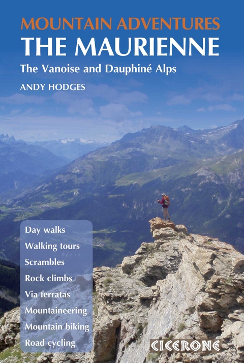
Mountain Adventures in the Maurienne
Cicerone Press (Verlag)
978-1-85284-621-3 (ISBN)
Multi-activity guidebook to the Haute Maurienne region of south east France. The book describes a wide range of the finest day walks, scrambles, rock climbs, via ferratas, treks and mountain biking and road cycling routes, offering all the inspiration needed for a multi-activity or family holiday.
The Maurienne valley is served by good transport links, Modane serves as the gateway to the upper valley with links from Paris and Turin served by the TGV. Lanslebourg is the largest village after Modane and offers plenty of choice of accommodation, and Termignon is a reasonably central base for exploring the Haute Maurienne. Routes vary from pretty Alpine lake rambles to mammoth mountain bike routes and include the normal route to the summit of Dent Parrachee, the Matterhorn of the valley that can be reached without crossing a glacier, and arranged by difficulty. Information about facilities and grades for each activity are carefully explained and routes are illustrated with sketch maps, topos and profiles and inspiring photographs.
The Vanoise massif is a beautiful range of mountains bounded by the valleys of the Maurienne and the Tarentaise. Sitting on the French-Italian border, the Upper Maurienne (Haute Maurienne) has a southern boundary bordering the Italian region of Piedmont. Its northern border is less pronounced, as the massif of the Vanoise blurs the boundary with the Tarentaise valley.
Ever since joining Cub Scouts as a boy in 1976 and learning about the outdoors, Andy Hodges has loved mountains. As a student he became a modern sports climber in France, while his summers were spent leading walking groups in the hills and mountains of the UK. A volunteer member of Mountain Rescue for 16 years, he has walked, climbed and cycled extensively in the Vanoise since discovering it for himself in 2004.
Introduction
Geography
The Vanoise National Park
Geology
Wildlife
Plants and flowers
History
Art and culture
Travel
When to go
Accommodation
Mountain refuges
Language
Insurance and rescue
Maps and navigation
Weather
Clothing
Wet weather alternatives
Using this guide
1 Day Walks
Route 1 Lac de l'Arcelle
Route 2 La Pierre aux Pieds
Route 3 Lac Blanc and Plan des Eaux
Route 4 Vallon de la Rocheure
Route 5 Pointe de Lanserlia
Route 6 Hannibal's Crossing (Col Clapier)
Route 7 Mont Froid
Route 8 Pointe de Bellecombe
Route 9 High Valley Walk
Route 10 Pointe de l'Observatoire
2 Mountaineering Routes
Route 11 Pointe Droset
Route 12 Cr&##xea;te de la Turra and Pointe du Grand Vallon
Route 13 Pointe des Fours
Route 14 3000ers Circuit
Route 15 Lessi&##xe8;res Traverse
Route 16 Le Petit Vallon
Route 17 Roche d'Etache
Route 18 Traverse of Pointe de Cugne
Route 19 North Ridge of Cime du Laro
Route 20 Signal du Petit Mont Cenis
Route 21 Ar&##xea;te de L&##xe9;ch&##xe9;
Route 22 La Dent Parrach&##xe9;e
3 Via Ferratas
Route 23 Le Pichet, Lanslevillard
Route 24 The Pinnacles, Aussois
Route 25 Guy Favre, Balme Noir
The Victor Emmanuel Fort Complex
Route 26 Travers&##xe9;e des Anges
Route 27 Mont&##xe9;e au Ciel
Route 28 Les Rois Mages
Route 29 Descente aux Enfers
Route 30 Remont&##xe9;e du Purgatoire
Via Ferrata/Rock Climbing
Route 31 Via Cordatta, Col de la Madeleine
4 Rock Climbing
Route 32 Rocher des Amoureux
Route 33 Solli&##xe8;res
Route 34 Rocher de Termignon
Route 35 Blocs de la Madeleine
Route 36 Dalles du Mollard
Route 37 Drailles Blanches
5 Mountain Biking
Bike hire and bike shops
The routes
Route 38 Termignon and Solli&##xe8;res Circuit
Route 39 La Girarde
Route 40 Champions' Loop
Route 41 Chemin du Petit Bonheur
Route 42 The Sardi&##xe8;res Monolith
Route 43 Mont Cenis Circuit
6 Road Rides
Route 44 Col du Mont Cenis
Route 45 Aussois Loop
Route 46 Col de l'Iseran
Route 47 Col du Galibier
7 Walking Tours
Route 48 Tour of the Vanoise Glaciers
Route 49 Tour of M&##xe9;an Martin
Route 50 Tour of Pointe de l'Echelle
Appendix A Route summary tables
Appendix B Useful contacts
Appendix C Useful phrases
| Erscheint lt. Verlag | 10.6.2011 |
|---|---|
| Reihe/Serie | Cicerone guidebooks |
| Zusatzinfo | c40 maps, topos and profiles and 90 colour photos |
| Verlagsort | Kendal |
| Sprache | englisch |
| Maße | 116 x 172 mm |
| Gewicht | 250 g |
| Themenwelt | Sachbuch/Ratgeber ► Sport |
| Reiseführer ► Europa ► Frankreich | |
| Reisen ► Sport- / Aktivreisen ► Europa | |
| ISBN-10 | 1-85284-621-6 / 1852846216 |
| ISBN-13 | 978-1-85284-621-3 / 9781852846213 |
| Zustand | Neuware |
| Haben Sie eine Frage zum Produkt? |
aus dem Bereich


