Street Map Port Elizabeth
2010
|
7th Revised edition
Struik Publishers,South Africa (Verlag)
978-1-77026-168-6 (ISBN)
Struik Publishers,South Africa (Verlag)
978-1-77026-168-6 (ISBN)
- Titel nicht im Sortiment
- Artikel merken
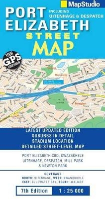
This updated street map now includes coverage of Summerstrand and has a detailed index of street and suburb names. The map includes street names, town names, main routes with route numbers, main intersections, schools, sports fields, hospitals and clinics, shopping malls, police stations, fire departments and places of interest. Coverage extent to the north is Uitenhage, to the west is Kwanobuhle, to the east is Bluewater Bay and to the south is Summerstrand.
| Erscheint lt. Verlag | 1.6.2010 |
|---|---|
| Sprache | englisch |
| Maße | 130 x 250 mm |
| Gewicht | 80 g |
| Themenwelt | Reisen ► Karten / Stadtpläne / Atlanten ► Afrika |
| ISBN-10 | 1-77026-168-0 / 1770261680 |
| ISBN-13 | 978-1-77026-168-6 / 9781770261686 |
| Zustand | Neuware |
| Haben Sie eine Frage zum Produkt? |
Mehr entdecken
aus dem Bereich
aus dem Bereich
Entdeckungsreisen im Land der San: von Gaborone zur größten …
Buch | Softcover (2024)
DuMont Reiseverlag
24,95 €
