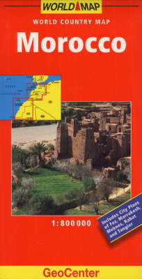
Morocco GeoCenter World Map
2007
Mairs Geographischer Verlag,Kurt Mair
978-3-8297-6444-5 (ISBN)
Mairs Geographischer Verlag,Kurt Mair
978-3-8297-6444-5 (ISBN)
- Keine Verlagsinformationen verfügbar
- Artikel merken
Part of the renowned Geocenter World Map series, this updated map of Morocco is both informative and easy-to-use. This map is ideal for travelling within the country and its city plans of Fez, Marrakesh, Meknes, Rabat and Tangier are perfect for day-to-day travelling within these cities. This map also has a scale of 1:800 Thousand.
Part of the renowned Geocenter World Map series, this updated map of Morocco is both informative and easy-to-use. This cartography is ideal for route-planning and travelling within the country, while its city plans of Fez, Marrakesh, Meknes, Rabat and Tangier are perfect for day-to-day travelling within these cities. This updated cartography now features grid references in the margin to aid quicker orientation. Additional colour changes to the mapping make transport networks clearer than before. With a scale of 1:800 Thousand and a legend in 8 languages, this is a comprehensive and indispensible road map. Tourist information, places of interest and a street index are all featured. Information is provided on hotels, restaurants, museums, theatres, parks and gardens, with tourist attractions clearly indicated and public transport systems marked.
Part of the renowned Geocenter World Map series, this updated map of Morocco is both informative and easy-to-use. This cartography is ideal for route-planning and travelling within the country, while its city plans of Fez, Marrakesh, Meknes, Rabat and Tangier are perfect for day-to-day travelling within these cities. This updated cartography now features grid references in the margin to aid quicker orientation. Additional colour changes to the mapping make transport networks clearer than before. With a scale of 1:800 Thousand and a legend in 8 languages, this is a comprehensive and indispensible road map. Tourist information, places of interest and a street index are all featured. Information is provided on hotels, restaurants, museums, theatres, parks and gardens, with tourist attractions clearly indicated and public transport systems marked.
| Erscheint lt. Verlag | 22.6.2007 |
|---|---|
| Reihe/Serie | GeoCenter World Map |
| Verlagsort | Ostfildern |
| Sprache | englisch |
| Themenwelt | Reisen ► Karten / Stadtpläne / Atlanten ► Afrika |
| ISBN-10 | 3-8297-6444-8 / 3829764448 |
| ISBN-13 | 978-3-8297-6444-5 / 9783829764445 |
| Zustand | Neuware |
| Haben Sie eine Frage zum Produkt? |
Mehr entdecken
aus dem Bereich
aus dem Bereich
Karte (gefalzt) (2024)
Freytag-Berndt und ARTARIA (Verlag)
12,90 €
Karte (gefalzt) (2023)
Freytag-Berndt und ARTARIA (Verlag)
12,90 €
reiß- und wasserfest (world mapping project)
Karte (gefalzt) (2024)
Reise Know-How (Verlag)
14,00 €


