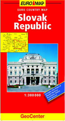
Slovak Republic GeoCenter Euro Map
2004
|
New edition
Mairs Geographischer Verlag,Kurt Mair
978-3-575-03182-2 (ISBN)
Mairs Geographischer Verlag,Kurt Mair
978-3-575-03182-2 (ISBN)
- Keine Verlagsinformationen verfügbar
- Artikel merken
Part of the renowned Geocenter Euro Country Map series, this updated map of Slovak Republic is both informative and easy-to-use. This map is ideal for route planning and has street plans of Banska, Bystrica, Bratislava, KoA'ice and Ostrava. This map has a scale of 1:300 Thousand.
Part of the renowned Geocenter Euro Country Map series, this updated map of Slovak Republic is both informative and easy-to-use. This cartography is ideal for planning routes through the countries and features street plans of Banska, Bystrica, Bratislava, KoA'ice and Ostrava. This updated cartography now features grid references in the margin to aid quicker orientation. Additional colour changes to the mapping make transport networks clearer than before. With a scale of 1:800 Thousand and a legend in 8 languages, this is a comprehensive and indispensible road map.
Part of the renowned Geocenter Euro Country Map series, this updated map of Slovak Republic is both informative and easy-to-use. This cartography is ideal for planning routes through the countries and features street plans of Banska, Bystrica, Bratislava, KoA'ice and Ostrava. This updated cartography now features grid references in the margin to aid quicker orientation. Additional colour changes to the mapping make transport networks clearer than before. With a scale of 1:800 Thousand and a legend in 8 languages, this is a comprehensive and indispensible road map.
| Erscheint lt. Verlag | 24.12.2004 |
|---|---|
| Reihe/Serie | GeoCenter Euro Map S. |
| Verlagsort | Ostfildern |
| Sprache | englisch |
| Maße | 130 x 250 mm |
| Themenwelt | Reisen ► Karten / Stadtpläne / Atlanten ► Europa |
| ISBN-10 | 3-575-03182-7 / 3575031827 |
| ISBN-13 | 978-3-575-03182-2 / 9783575031822 |
| Zustand | Neuware |
| Haben Sie eine Frage zum Produkt? |
Mehr entdecken
aus dem Bereich
aus dem Bereich
Karte (gefalzt) (2023)
Freytag-Berndt und ARTARIA (Verlag)
12,90 €
Straßen- und Freizeitkarte 1:250.000
Karte (gefalzt) (2023)
Freytag-Berndt und ARTARIA (Verlag)
12,90 €
Narvik
Karte (gefalzt) (2023)
Freytag-Berndt und ARTARIA (Verlag)
12,90 €


