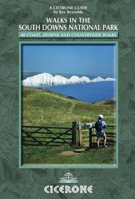
Walks in the South Downs National Park
Cicerone Press (Verlag)
978-1-85284-618-3 (ISBN)
- Titel ist leider vergriffen;
keine Neuauflage - Artikel merken
A walking guide to the South Downs National Park. 40 day walks for all abilities are described, from Winchester to Eastbourne. With some of the most iconic landscapes in southern England, including the white chalk cliffs of Beachy Head and the Seven Sisters, and such well-loved landmarks as Ditchling Beacon and atmospheric ancient monuments like the Cissbury Ring, walking in the park proves a delightful experience mile after mile. Each walk is circular, and where possible beginning and ending at a place accessible by public transport. The walks are described step by step illustrated with OS mapping and colour photographs.
Freelance author, photojournalist and lecturer Kev Reynolds has walked, trekked or climbed in some of the world's most spectacular mountains and landscapes, including the Alps, Nepal, Norway, Peru, the Pyrenees and Turkey (to name but a few). Despite having such a well-travelled CV, he retains a keen passion for the more homely landscapes of southern England - especially the South Downs, which he visits at every opportunity.
INTRODUCTION
The Essential Downs
Plants and Wildlife of the Downs
Walking on the Downs
Using the Guide
Public Transport and Car Parking
Where to Stay
The Country Code
THE WALKS
1 Eastbourne to Birling Gap and East Dean (9½ miles)
2 Butts Brow to Jevington and Friston (7 miles)
3 Jevington to Friston Forest and the Long Man (7½ miles)
4 Jevington to Alfriston and Wilmington (8½ miles)
5 Exceat to East Dean and the Seven Sisters (8 miles)
6 Exceat to the Cuckmere Valley and Alfriston (7 miles)
7 Exceat Bridge to Cuckmere Haven and Seaford Head (6½ miles)
8 Alfriston to The Long Man of Wilmington (5 miles)
9 Alfriston to Bostal Hill, Alciston and Berwick (7 miles)
10 Bopeep to Bishopstone (7½ miles)
11 Glynde to Beddingham Hill, Firle Beacon and Bostal Hill (11 miles)
12 Glynde to Mount Caburn and Saxon Cross (6 miles)
13 Southease Station to Rodmell and Telscombe (7½ miles)
14 Cooksbridge to Plumpton Plain and Buckland Bank (10 miles)
15 Hassocks to the Clayton Windmills and Ditchling Beacon (10 miles)
16 Devil's Dyke to Edburton Hill and Poynings (6½ miles)
17 Devil's Dyke to Mile Oak Barn and Edburton Hill (6½ miles)
18 Wiston to No Man's Land (6½ miles)
19 Findon to Cissbury Ring (7 miles)
20 Washington to Chanctonbury Ring (4¾ miles)
21 Washington to Kithurst Hill (7½ miles)
22 Chantry Post to Myrtle Grove Farm (7 miles)
23 Storrington to Parham Park and Rackham Hill (7½ miles)
24 Amberley to The Burgh (6¾ miles)
25 Burpham to Angmering Park (6 miles)
26 Arundel to South Stoke and Burpham (8 miles)
27 Bignor Hill to Sutton (6¼ miles)
28 Bignor Hill to Slindon (7¾ miles)
29 Duncton to Barlavington and Sutton (5 or 6 miles)
30 Singleton to Littlewood Farm (5½ miles)
31 West Stoke to Kingley Vale and Stoughton (6½ miles)
32 Compton to East Marden (5 miles)
33 Harting Down to Beacon Hill and Telegraph House (5 miles)
34 East Meon to Salt Hill (5 miles)
35 East Meon to Small Down (6 miles)
36 West Meon to Brockwood Copse (5 miles)
37 West Meon to Old Winchester Hill and Henwood Down (9 miles)
38 Exton to Warnford and Beacon Hill (6 miles)
39 Exton to Lomer Farm (6½ miles)
40 Cheriton to Tichborne (6½ miles)
APPENDIX A: Useful Addresses
APPENDIX B: Bibliography
| Erscheint lt. Verlag | 18.3.2011 |
|---|---|
| Zusatzinfo | 100 colour photos and 40 OS maps |
| Verlagsort | Kendal |
| Sprache | englisch |
| Maße | 116 x 172 mm |
| Gewicht | 250 g |
| Themenwelt | Sachbuch/Ratgeber ► Sport |
| Reiseführer ► Europa ► Großbritannien | |
| ISBN-10 | 1-85284-618-6 / 1852846186 |
| ISBN-13 | 978-1-85284-618-3 / 9781852846183 |
| Zustand | Neuware |
| Haben Sie eine Frage zum Produkt? |
aus dem Bereich


