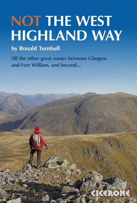
Not the West Highland Way
Cicerone Press (Verlag)
978-1-85284-615-2 (ISBN)
- Titel ist leider vergriffen;
keine Neuauflage - Artikel merken
Looking to walk the West Highland Way but avoid the crowds? Want to explore the larger mountains nearby, embark on serious backpacking trips, or continue north from Fort William? This guidebook takes the best of the Way and adds to it, offering detailed access, public transport, and facility information, over 100 photos, 1:50k OS mapping, detailed route description and overview maps. The routes are perfect for walking from April to October and suitable for backpackers of all levels. The guide's four parts are:
Mountain alternatives to eight of the nine stages of the WHW. Use the conventional overnight stops but divert onto mountains during the day for some Munro-bagging (Ben Lomond, Beinn Chabhair, Ben Lui, An Caisteal, and Beinn a'Chròin), plus smaller fells like the Mamores and Campsie fells.
Beginner backpacking trips with two two-day routes around Fort William's outskirts: the back of Ben Nevis and Taynuilt to Bridge of Orchy.
Divergent routes north through remote glens and over mountains. Start from Dumbarton or Arrochar, cross the main WH way at Inverarnan, then cross Ben Lui and Loch Etive, Kinlochleven, Loch Treig, Lairig Leacach, and finish at Spean Bridge.
Extend your journey from Fort William with multi-day excursions like Corrour to Dalwhinnie, Fort William to Inverie, Spean Bridge to Cluanie, or Cape Wrath expeditions.
Multi-award winning author Ronald Turnbull has written many Cicerone books on challenge-walking, bivvying and walking in Scotland. After walking bits of it, and above and around it, he finally gave in and walked the West Highland Way in March 2008.
Introduction
The High Road and the Low
When to go
Safety in the mountains
Maps
How to use this book
A Winter Not the West Highland Way
Part 1 The High Road and the Low
Milngavie to Drymen
1 Hill Option: the Campsie Fells
Drymen to Rowardennan
Rowardennan to Inversnaid
2 Rowardennan Outing: Ben Lomond
3 Hill Crossing: Ben Lomond to Inversnaid
Inversnaid to Inverarnan
4 Hill Crossing: Beinn a' Choin
5 Inverarnan Outing: Beinn Chabhair
Inverarnan to Tyndrum
6 Hill Crossing: Ben Lui
7 Crianlarich Outing: An Caisteal and Beinn a' Chroin
Tyndrum to Inveroran
8 Hill Crossing: the Back of Beinn Dorain
9 Inveroran Outing: Ben Inverveigh and Meall Tairbh
Inveroran to Kings House
10 Hill Crossing: Black Mount
Kings House to Kinlochleven
11 Hill Crossing: Beinn a' Chrulaiste and the Blackwater
Kinlochleven to Fort William
12 Hill Crossing: Mamores
13 Hill Crossing: More Mamores
14 Fort William Outing: Ben Nevis by the CMD Ar&##xea;te
Part 2 Beginnerish Backpacking
The excitement is in tents
Midges are unpleasant
May is the month
Shoulder-strengthening short trips
The off-route food-fetching formula
Stuff, stuffsacks, and throwing it all away
15 A mostly gentle two-day: the Back of Ben Nevis
16 A wilder two-day: Taynuilt to Bridge of Orchy
Part 3 Away from the Way
17 Dumbarton Start
18 Wrong side of the Loch: the Arrochar Alps
19 The Etive Trek
20 Blackwater and the Lairig Leacach
21 Routes of Rannoch
Part 4 Roads to the Deep North
22 Corrour to Dalwhinnie
23 Fort William to Inverie
24 Spean Bridge to Cluanie and even Cape Wrath
Appendix 1: Access
Appendix 2: Useful information
Appendix 3: Further reading
| Erscheint lt. Verlag | 18.4.2017 |
|---|---|
| Reihe/Serie | Cicerone guidebooks |
| Zusatzinfo | Over 100 photos and 20 colour maps |
| Verlagsort | Kendal |
| Sprache | englisch |
| Maße | 116 x 172 mm |
| Gewicht | 300 g |
| Themenwelt | Sachbuch/Ratgeber ► Sport |
| Reisen ► Sport- / Aktivreisen ► Europa | |
| ISBN-10 | 1-85284-615-1 / 1852846151 |
| ISBN-13 | 978-1-85284-615-2 / 9781852846152 |
| Zustand | Neuware |
| Informationen gemäß Produktsicherheitsverordnung (GPSR) | |
| Haben Sie eine Frage zum Produkt? |
aus dem Bereich
