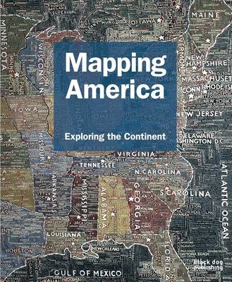
Mapping America
Exploring the Continent
Seiten
2010
Black Dog Publishing London UK (Verlag)
978-1-907317-08-8 (ISBN)
Black Dog Publishing London UK (Verlag)
978-1-907317-08-8 (ISBN)
Following on from Mapping New York and Mapping London, Mapping America: Exploring the Continent takes a similar approach in its presentation, thematically arranging a vivid collection of historic, demographic, cultural and artistic maps to aid the reader on their journey. Featuring four centuries of maps that depict the changing landscape of North America, Mapping America charts the continent through numerous landmark events and uprisings, including the Civil War, the Civil Rights Movement, and more recent concerns, such as the environment and terrorism.
From early maps depicting the country’s colonial beginnings, through to contemporary maps depicting America today, the book presents the reader with a multi-faceted view of the North American physical and cultural landscape; from maps showing the electoral routes of Presidential campaigns, to the diminishing native communities shown in census maps, to maps charting the country’s health statistics.
Alongside the historic, geographic, and political, the book also pays particular attention to the artistic and imaginative, documenting America’s rich and descriptive literary and artistic past. The journey taken by Jack Kerouac in the seminal book On the Road is documented in a hand-drawn map, whilst numerous artists known for their interest in cartography will be featured, from the representational to the abstract, including Paula Scher with The United States and Daniel Medina with Map Cube World.
Not just for cartography enthusiasts, Mapping America: Exploring the Continent appeals to the general reader, as well as specialists in the areas of geography, art, architecture and design. The book's breadth of material, with a variety of maps ranging from the historically accurate to the imaginative and entertaining, makes it accessible to all, and a perfect Christmas gift.
Fritz Kessler is a Professor of Geography at Frostburg State University, he is editor of Cartographic Perspectives Journal and contributed to various books on the subject.
| Erscheint lt. Verlag | 18.11.2010 |
|---|---|
| Zusatzinfo | Illustrations |
| Sprache | englisch |
| Maße | 241 x 292 mm |
| Gewicht | 1786 g |
| Themenwelt | Reisen ► Karten / Stadtpläne / Atlanten ► Welt / Arktis / Antarktis |
| Naturwissenschaften ► Geowissenschaften ► Geografie / Kartografie | |
| ISBN-10 | 1-907317-08-2 / 1907317082 |
| ISBN-13 | 978-1-907317-08-8 / 9781907317088 |
| Zustand | Neuware |
| Haben Sie eine Frage zum Produkt? |
Mehr entdecken
aus dem Bereich
aus dem Bereich
mit Fakten und Infos zu allen Kontinenten
Buch | Hardcover (2024)
Kosmos Kartografie in der Franckh-Kosmos Verlags-GmbH & Co. …
24,00 €


