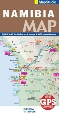
Road Map Namibia
2009
|
3rd Revised edition
Struik Publishers,South Africa (Verlag)
978-1-77026-133-4 (ISBN)
Struik Publishers,South Africa (Verlag)
978-1-77026-133-4 (ISBN)
- Titel ist leider vergriffen;
keine Neuauflage - Artikel merken
Detailed road map of Namibia at 1 : 550 000; information boxes on all parks in Namibia; useful contact details; index of all towns on map.
Detailed road map of Namibia at 1 : 550 000; information boxes on all parks in Namibia; useful contact details; index of all towns on map; GPS co-ordinates; includes detailed street plans & information boxes of Grootfontein; Keetmanshoop; Kolmanskop; Luderitz; Otjiwarongo; Swakopmund; Walvis Bay; Windhoek detailed area maps of: Ai-ais; Richersveld Transfrontier Park, including a chart showing distances between camps; Etosha National Park; Mudumu & Mamili National Park.
Detailed road map of Namibia at 1 : 550 000; information boxes on all parks in Namibia; useful contact details; index of all towns on map; GPS co-ordinates; includes detailed street plans & information boxes of Grootfontein; Keetmanshoop; Kolmanskop; Luderitz; Otjiwarongo; Swakopmund; Walvis Bay; Windhoek detailed area maps of: Ai-ais; Richersveld Transfrontier Park, including a chart showing distances between camps; Etosha National Park; Mudumu & Mamili National Park.
| Erscheint lt. Verlag | 1.10.2009 |
|---|---|
| Sprache | englisch |
| Maße | 130 x 250 mm |
| Gewicht | 83 g |
| Themenwelt | Reisen ► Karten / Stadtpläne / Atlanten ► Afrika |
| ISBN-10 | 1-77026-133-8 / 1770261338 |
| ISBN-13 | 978-1-77026-133-4 / 9781770261334 |
| Zustand | Neuware |
| Haben Sie eine Frage zum Produkt? |
Mehr entdecken
aus dem Bereich
aus dem Bereich
Karte (gefalzt) (2024)
Freytag-Berndt und ARTARIA (Verlag)
12,90 €
Karte (gefalzt) (2023)
Freytag-Berndt und ARTARIA (Verlag)
12,90 €
reiß- und wasserfest (world mapping project)
Karte (gefalzt) (2024)
Reise Know-How (Verlag)
14,00 €


