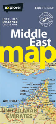
Middle East Road Map
Seiten
2012
Explorer Publishing (Verlag)
978-9948-442-16-5 (ISBN)
Explorer Publishing (Verlag)
978-9948-442-16-5 (ISBN)
- Titel ist leider vergriffen;
keine Neuauflage - Artikel merken
The Middle East Map is the most accurate and up-to-date map of the whole region. Stretching all the way from Turkey across the Arabian Peninsula and beyond, it covers this varied area for easy navigation... we've got the Middle East covered.
The new Middle East Road Map is the most accurate and comprehensive map of the Middle East, and the best way to find your way around the region. With a clean, easy-to-read design, the whole of the Middle East is covered on one map that reaches UAE, Oman, Yemen, Saudi Arabia, Bahrain, Qatar, Kuwait, Syria, Jordan, Lebanon, Turkey, Iraq and Iran. Using the most up-to-date mapping available, it shows all cities, towns and villages, and key landmarks such as hotels, airports, markets, mountains and wadis, with a handy directory of map references so you can easily find your way about.
The new Middle East Road Map is the most accurate and comprehensive map of the Middle East, and the best way to find your way around the region. With a clean, easy-to-read design, the whole of the Middle East is covered on one map that reaches UAE, Oman, Yemen, Saudi Arabia, Bahrain, Qatar, Kuwait, Syria, Jordan, Lebanon, Turkey, Iraq and Iran. Using the most up-to-date mapping available, it shows all cities, towns and villages, and key landmarks such as hotels, airports, markets, mountains and wadis, with a handy directory of map references so you can easily find your way about.
| Reihe/Serie | Road Maps |
|---|---|
| Verlagsort | Dubai |
| Sprache | englisch |
| Maße | 220 x 230 mm |
| Gewicht | 7 g |
| Themenwelt | Reisen ► Karten / Stadtpläne / Atlanten ► Naher Osten |
| Reisen ► Karten / Stadtpläne / Atlanten ► Asien | |
| ISBN-10 | 9948-442-16-4 / 9948442164 |
| ISBN-13 | 978-9948-442-16-5 / 9789948442165 |
| Zustand | Neuware |
| Haben Sie eine Frage zum Produkt? |
Mehr entdecken
aus dem Bereich
aus dem Bereich
reiß- und wasserfest (world mapping project)
Karte (gefalzt) (2024)
Reise Know-How (Verlag)
14,00 €
Karte (gefalzt) (2024)
Freytag-Berndt und ARTARIA (Verlag)
12,90 €
Karte (gefalzt) (2023)
Reise Know-How (Verlag)
12,00 €


