Java & Bali Travel Map Third Edition
2010
|
3rd Revised edition
Periplus Editions (Verlag)
978-0-7946-0618-3 (ISBN)
Periplus Editions (Verlag)
978-0-7946-0618-3 (ISBN)
- Titel erscheint in neuer Auflage
- Artikel merken
Zu diesem Artikel existiert eine Nachauflage
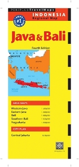
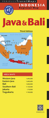
This specialist regional map covers Java and Bali to a scale of 1:600,000. It also includes detailed maps of Western and Eastern Java, Bali, Southern Bali Jakarta and Yogyakarta, all to varying scales.
This specialist regional map covers Bali to a scale of 1:600,000. It also includes detailed maps of Jakarta at a scale of 1:70,000, Yogyakarta at 100,000, Southern Bali at 1:120,000 and Bali, Western and Eastern Java, at 1:600,000. The design of this map allows for one panel to be viewed at a time, for ease of use, and includes a comprehensive selection of tourist attractions.
This specialist regional map covers Bali to a scale of 1:600,000. It also includes detailed maps of Jakarta at a scale of 1:70,000, Yogyakarta at 100,000, Southern Bali at 1:120,000 and Bali, Western and Eastern Java, at 1:600,000. The design of this map allows for one panel to be viewed at a time, for ease of use, and includes a comprehensive selection of tourist attractions.
| Erscheint lt. Verlag | 6.10.2010 |
|---|---|
| Reihe/Serie | Periplus Maps |
| Zusatzinfo | Illustrations |
| Verlagsort | Boston |
| Sprache | englisch |
| Maße | 260 x 108 mm |
| Themenwelt | Reisen ► Karten / Stadtpläne / Atlanten ► Asien |
| ISBN-10 | 0-7946-0618-0 / 0794606180 |
| ISBN-13 | 978-0-7946-0618-3 / 9780794606183 |
| Zustand | Neuware |
| Haben Sie eine Frage zum Produkt? |
Mehr entdecken
aus dem Bereich
aus dem Bereich
Karte (gefalzt) (2024)
Freytag-Berndt und ARTARIA (Verlag)
12,90 €
reiß- und wasserfest (world mapping project)
Karte (gefalzt) (2024)
Reise Know-How (Verlag)
12,00 €
Karte (gefalzt) (2024)
Reise Know-How (Verlag)
14,00 €
