


Belfast Streetfinder Atlas
Seiten
2000
|
Revised edition
Collins (Verlag)
978-0-00-449004-5 (ISBN)
Collins (Verlag)
978-0-00-449004-5 (ISBN)
- Titel erscheint in neuer Auflage
- Artikel merken
Zu diesem Artikel existiert eine Nachauflage
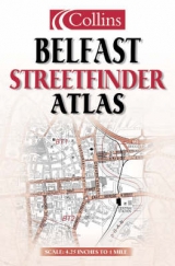
4.25 inches to 1 mile Brand new, clear easy to use street level mapping with full index.
MAIN FEATURES
• Popular street atlas covering an extensive area of Greater Belfast
INCLUDES
• Brand new mapping for year 2000
• All classified roads and streets
• All important buildings and places of interest
• Car parks and railway stations
• Full index to street names
AREA OF COVERAGE
Extensive area of coverage from Andersonstown to Holywood and from Belfast Castle to Newtownbreda.
WHO THE PRODUCT IS AIMED AT
Ideal for the resident, visitor or tourist.
| Erscheint lt. Verlag | 3.4.2000 |
|---|---|
| Verlagsort | London |
| Sprache | englisch |
| Maße | 142 x 216 mm |
| Gewicht | 74 g |
| Themenwelt | Reisen ► Karten / Stadtpläne / Atlanten ► Europa |
| Reiseführer ► Europa ► Irland | |
| ISBN-10 | 0-00-449004-5 / 0004490045 |
| ISBN-13 | 978-0-00-449004-5 / 9780004490045 |
| Zustand | Neuware |
| Informationen gemäß Produktsicherheitsverordnung (GPSR) | |
| Haben Sie eine Frage zum Produkt? |
Mehr entdecken
aus dem Bereich

aus dem Bereich
65 Wander- und Entdeckertouren an der irischen Westküste
Buch | Softcover (2024)
Naturzeit Reiseverlag
22,00 €
individuell reisen mit vielen praktischen Tipps
Buch | Softcover (2024)
Michael Müller (Verlag)
32,90 €