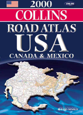
2000 Road Atlas USA, Canada and Mexico
Seiten
1999
|
Revised edition
Collins (Verlag)
978-0-00-448956-8 (ISBN)
Collins (Verlag)
978-0-00-448956-8 (ISBN)
- Titel erscheint in neuer Auflage
- Artikel merken
Zu diesem Artikel existiert eine Nachauflage
Collins edition of the Rand McNally Road Atlas USA, America’s bestselling road atlas. Fully revised for 2000 with state by state road map coverage, and including population figures from the latest US census. Various scales.
AREA OF COVERAGE
All of North America – United States, Canada, Mexico. From Alaska to the Gulf of Mexico, and from California to New York. Also includes Hawaii and Puerto Rico, and the new Canadian territory of Nunavut.
MAIN FEATURES
Fully up-to-date road mapping,tourist information. State-by-state mapping. U S National Parks maps. City and urban area maps.
INCLUDES
Fully classified road network, state-by-state indexes to place names, road signs, route planning map and State Fairs calendar.
WHO THE PRODUCT IS AIMED AT
Armchair traveller and anyone planning a trip to North America
OTHER PRODUCTS IN THE SERIES
Collins Road Atlas Britain
Collins Road Atlas Europe
Collins Road Atlas France
Collins Road Atlas Italy
Collins Road Atlas Spain & Portugal
| Erscheint lt. Verlag | 6.12.1999 |
|---|---|
| Verlagsort | London |
| Sprache | englisch |
| Maße | 280 x 390 mm |
| Gewicht | 544 g |
| Themenwelt | Reisen ► Karten / Stadtpläne / Atlanten ► Nord- / Mittelamerika |
| ISBN-10 | 0-00-448956-X / 000448956X |
| ISBN-13 | 978-0-00-448956-8 / 9780004489568 |
| Zustand | Neuware |
| Haben Sie eine Frage zum Produkt? |
Mehr entdecken
aus dem Bereich
aus dem Bereich


