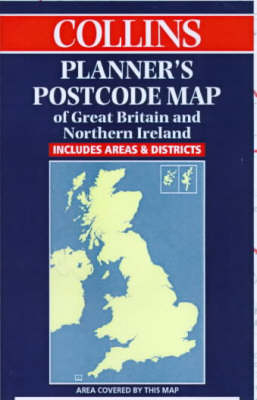
Collins Planners’ Postcode Map of Great Britain and Northern Ireland
1999
|
New edition
Collins (Verlag)
978-0-00-449009-0 (ISBN)
Collins (Verlag)
978-0-00-449009-0 (ISBN)
- Titel erscheint in neuer Auflage
- Artikel merken
Zu diesem Artikel existiert eine Nachauflage
1:850,000 Planning map of Great Britain and Northern Ireland printed in two colours with postcode areas clearly shown.
MAIN FEATURES
Clear planning map with postcode areas clearly shown in red on a grey base.
INCLUDES
Simplified base map in grey showing basic road network and administrative areas. Enlarged inset of major urban areas showing boroughs on the base map, superimposed by postcode areas.
AREA OF COVERAGE
Covers Great Britain and Northern Ireland.
WHO THE PRODUCT IS AIMED AT
Aimed specifically at the business user for planning purposes.
| Erscheint lt. Verlag | 6.9.1999 |
|---|---|
| Zusatzinfo | M. |
| Verlagsort | London |
| Sprache | englisch |
| Maße | 1270 x 914 mm |
| Gewicht | 192 g |
| Themenwelt | Reisen ► Karten / Stadtpläne / Atlanten ► Europa |
| ISBN-10 | 0-00-449009-6 / 0004490096 |
| ISBN-13 | 978-0-00-449009-0 / 9780004490090 |
| Zustand | Neuware |
| Haben Sie eine Frage zum Produkt? |
Mehr entdecken
aus dem Bereich
aus dem Bereich
Straßen- und Freizeitkarte 1:250.000
Karte (gefalzt) (2023)
Freytag-Berndt und ARTARIA (Verlag)
12,90 €
Karte (gefalzt) (2023)
Freytag-Berndt und ARTARIA (Verlag)
12,90 €
Narvik
Karte (gefalzt) (2023)
Freytag-Berndt und ARTARIA (Verlag)
12,90 €


