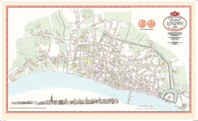
The City of London Map 1520
The Most Detailed Map of Late Medieval London
2008
Shire Publications (Verlag)
978-1-873590-78-2 (ISBN)
Shire Publications (Verlag)
978-1-873590-78-2 (ISBN)
- Titel ist leider vergriffen;
keine Neuauflage - Artikel merken
The capital city c.1520 during the reign of Henry VIII showing major streets, lanes, churches, great houses, monasteries and public buildings. This map reveals medieval London at its most impressive, before the city was overwhelmed by a massive population explosion.
The capital city in 1520 during the reign of Henry VIII showing major streets, lanes, churches, great houses, monasteries and public buildings. This map reveals medieval London at its most impressive, before the city was overwhelmed by a massive population explosion. In the course of the sixteenth century the number of Londoners grew from 50,000 to 200,000. At the same time the City's thirty monastic houses were dissolved, their buildings sold and their gardens covered with cramped and poorly-built housing. This is the map of a lost garden city. The buildings and streets of medieval London have almost all completely disappeared. The monastic houses were dissolved in the sixteenth century; the Great Fire of 1666 destroyed two thirds of the city; the Roman walls were swept away in the eighteenth century; Victorian roads and railways cut swathes through the medieval street plan and the bombing of the Second World War destroyed most of what had survived the Fire.
Fewer than a dozen medieval buildings are left in the City of London today and so this map has had to be re-constructed by historians who have studied the surviving documents and by archaeologists who have provided evidence from the medieval remains now buried below the present street level. Their painstaking work has made it possible to create this map of the medieval city as it was five hundred years ago in the early years of the sixteenth century when the Scottish poet William Dunbar admired London and celebrated it as 'The Flower of Cities All'.
| Zusatzinfo | Coloured map and riverside panorama |
|---|---|
| Verlagsort | London |
| Sprache | englisch |
| Maße | 930 x 600 mm |
| Gewicht | 131 g |
| Themenwelt | Geisteswissenschaften ► Geschichte ► Hilfswissenschaften |
| Naturwissenschaften ► Geowissenschaften ► Geografie / Kartografie | |
| ISBN-10 | 1-873590-78-4 / 1873590784 |
| ISBN-13 | 978-1-873590-78-2 / 9781873590782 |
| Zustand | Neuware |
| Haben Sie eine Frage zum Produkt? |