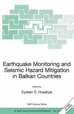
Earthquake Monitoring and Seismic Hazard Mitigation in Balkan Countries
Springer-Verlag New York Inc.
978-1-4020-6814-0 (ISBN)
- Titel z.Zt. nicht lieferbar
- Versandkostenfrei innerhalb Deutschlands
- Auch auf Rechnung
- Verfügbarkeit in der Filiale vor Ort prüfen
- Artikel merken
This abruptly changed with the political interest in seismology as the principal tool for monitoring compliance with a potential Comprehensive Nuclear Test Ban treaty (CTBT) banning nuclear testing in any environment.
Major countries like USA, UK and USSR launched large-scale research programs including deployment of modern seismograph stations and arrays and these developments are detailed in the book for CTBTO (UN), IRIS (USA), MedNet (Italy), Geofon (Germany) and the tiny Karelia network, NW Russia. Station and network operations require near real time record analysis and topics dealt with here are 2-D signal detector, epicenter location and earthquake monitoring. Balkan is seismically the most active part of Europe due to multiple plate interactions in the Aegean Sea. The tectonic evolution and on-going geodynamic deformations are described in 2 articles. Earthquake hazard analysis and topographic site effects are discussed and likewise large earthquake hazards in the Aegean and the Marmara seas relate to practical applications of such procedures. Foremost; the book gives a good account of past, present and likely future seismological developments in Balkan countries and various kinds of network operations on local to global scales.
Tectonic Framework and Geodynamics of the South Balkan Region.- Patterns of Cenozoic Extensional Tectonism in the South Balkan Extensional System.- Crustal Motion and Strain Accumulation in the South Balkan Region Inferred from GPS Measurements.- Seismicity Studies in the South Balkan Region.- Recent Devastating Earthquakes in Turkey and Active Tectonics of the Aegean and Marmara Seas.- Estimates of Stress Drop and High Frequency Diminution Parameter from Strong Motion Data Recorded in Albania.- Seismicity of Croatia.- Seismicity of the Pannonian Basin.- Seismic Network Operations on Global, Regional and National Scales.- The CTBTO International Monitoring System and Global Seismicity.- The IRIS Consortium: Community Based Facilities and Data Management for Seismology.- The Mediterranean Broad Band Seismographic Network Anno 2005/06.- GEOFON and its Role in Earthquake Monitoring and Tsunami Warning.- The Karelian Regional Seismic Network in NW Russia.- Seismic Network Operations, Event Location and 2-D Signal Detection.- Cossack Ranger II – A High Quality, Versatile and Affordable 3-Component Short-Period Seismograph.- A 2-D Seismic Signal Detector for Stand Alone 3-Component stations.- Accurate Location of Seismic Sources With and Without Travel Time Model.- Earthworm Auto-Earthquake Location Performance and Recent Improvements in Seismic Data Acquisition, Processing, Archiving and Dissemination at Kandilli Observatory and Earthquake Research Institute.- Seismic Hazard Analysis and Assessment.- Data Driven Probabilistic Seismic Hazard Assessment Procedure for Regions with Uncertain Seimogenic Zones.- Seismicity and Seismic Hazard Assessment in Greece.- Are Rock Avalanches and Landslides Due to Large Earthquakes or Local Topographic Effects? A Case Study of the LurøyEarthquake of August 31, 1819, A 3D Finite Difference Approach.
| Erscheint lt. Verlag | 3.4.2008 |
|---|---|
| Reihe/Serie | Nato Science Series: IV: Earth and Environmental Sciences ; 81 |
| Zusatzinfo | XVIII, 289 p. With CD-ROM. |
| Verlagsort | New York, NY |
| Sprache | englisch |
| Maße | 155 x 235 mm |
| Themenwelt | Naturwissenschaften ► Geowissenschaften ► Geologie |
| Naturwissenschaften ► Geowissenschaften ► Geophysik | |
| ISBN-10 | 1-4020-6814-X / 140206814X |
| ISBN-13 | 978-1-4020-6814-0 / 9781402068140 |
| Zustand | Neuware |
| Haben Sie eine Frage zum Produkt? |
aus dem Bereich


