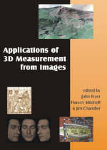
Applications of 3D Measurement from Images
Seiten
2007
Whittles Publishing
978-1-870325-69-1 (ISBN)
Whittles Publishing
978-1-870325-69-1 (ISBN)
- Titel wird leider nicht erscheinen
- Artikel merken
Reveals through a series of case studies how modern digital photogrammetry is capable of providing accurate spatial data to solve a range of contemporary measurement problems, and at a diverse range of scales. This book outlines key principles and methods associated with modern imaging.
This outstanding new book reveals through a series of case studies how modern digital photogrammetry is capable of providing dense and accurate spatial data to solve a wide range of contemporary measurement problems, and at a diverse range of scales. It outlines key principles and methods associated with modern imaging and puts this into context with other modern spatial measurement techniques, including a full discussion of laser scanning. It will therefore be of major importance to practitioners in a wide range of disciplines who require spatial data and have identified imaging as a tool that could be used. Each chapter focuses on a specific topic including archaeology/architecture, medicine/dentistry/sports science, forensics, landform evolution, industrial, manufacturing, engineering, biology and zoology, and provides specific examples which demonstrate the range in measurement scale achievable by photogrammetry.
This outstanding new book reveals through a series of case studies how modern digital photogrammetry is capable of providing dense and accurate spatial data to solve a wide range of contemporary measurement problems, and at a diverse range of scales. It outlines key principles and methods associated with modern imaging and puts this into context with other modern spatial measurement techniques, including a full discussion of laser scanning. It will therefore be of major importance to practitioners in a wide range of disciplines who require spatial data and have identified imaging as a tool that could be used. Each chapter focuses on a specific topic including archaeology/architecture, medicine/dentistry/sports science, forensics, landform evolution, industrial, manufacturing, engineering, biology and zoology, and provides specific examples which demonstrate the range in measurement scale achievable by photogrammetry.
Professor John Fryer is Emeritus Professor of Photogrammetry and Surveying, School of Engineering, University of Newcastle, NSW; Dr. Harvey Mitchell is Senior Lecturer, School of Engineering, University of Newcastle, NSW; Dr. Jim Chandler is Senior Lecturer in Land Surveying and Photogrammetry, Loughborough University, Loughborough, UK
Introduction; Fundamentals of Photogrammetry; Structural Monitoring; Engineering and Manufacturing; Forensic Photogrammetry; Quantifying Landform Change; Medicine and Sport - Measurement of Humans; Biology and Zoology; Cultural Heritage Documentation; Sensor Integration and Visualisation; Index
| Erscheint lt. Verlag | 4.10.2007 |
|---|---|
| Zusatzinfo | liberally illustrated with a colour section |
| Verlagsort | Caithness |
| Sprache | englisch |
| Maße | 156 x 234 mm |
| Themenwelt | Naturwissenschaften ► Geowissenschaften ► Geografie / Kartografie |
| Technik ► Bauwesen | |
| Technik ► Maschinenbau | |
| ISBN-10 | 1-870325-69-9 / 1870325699 |
| ISBN-13 | 978-1-870325-69-1 / 9781870325691 |
| Zustand | Neuware |
| Haben Sie eine Frage zum Produkt? |
Mehr entdecken
aus dem Bereich
aus dem Bereich
Wasserstraßen zwischen Emmerich, Hörstel und Mainz
Media-Kombination (2023)
Kartenwerft
49,90 €
Media-Kombination (2018)
Cambridge University Press
41,50 €
Der Klassiker unter den Strategiespielen
Spiel (2023)
Laurence King Verlag
30,00 €


