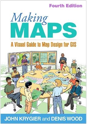
Making Maps, Fourth Edition
Guilford Press (Verlag)
978-1-4625-5606-9 (ISBN)
- Lieferbar (Termin unbekannt)
- Versandkostenfrei innerhalb Deutschlands
- Auch auf Rechnung
- Verfügbarkeit in der Filiale vor Ort prüfen
- Artikel merken
New to This Edition
*New or expanded topics: graduated symbol maps, multivariate choropleth maps, visual storytelling, maps and gerrymandering, artificial intelligence, workflow, and more.
*Integration of practical ideas from Indigenous and feminist perspectives.
*Coverage of color and type is shifted earlier in the book, and the chapters on map symbolization and abstraction now conclude the book, with many compelling new maps.
John Krygier, PhD, is Professor in the Department of Environment and Sustainability at Ohio Wesleyan University, with teaching and research specializations in cartography, geographic information systems (GIS), and environmental and human geography. He has made lots of maps and published on map design, educational technology, cultural geography, multimedia in cartography, planning, the history of cartography, and participatory GIS. Denis Wood, PhD, is an independent scholar living in Raleigh, North Carolina. He curated the award-winning Power of Maps exhibition for the Smithsonian and writes widely about maps. He is a former professor of design at North Carolina State University.
1. How to Make a Map
2. What’s Your Map For?
3. Mappable Data
4. Map Making Tools
5. Geographic Framework
6. The Big Picture of Map Design
7. The Inner Workings of Map Design
8. Color on Maps
9. Words on Maps
10. Map Generalization and Classification
11. Map Symbolization
12. Map Symbol Abstraction
A Note to the Users of Making Maps
Acknowledgments / About the Authors
Index
| Erscheinungsdatum | 01.11.2024 |
|---|---|
| Verlagsort | New York |
| Sprache | englisch |
| Maße | 178 x 254 mm |
| Themenwelt | Naturwissenschaften ► Geowissenschaften ► Geografie / Kartografie |
| ISBN-10 | 1-4625-5606-X / 146255606X |
| ISBN-13 | 978-1-4625-5606-9 / 9781462556069 |
| Zustand | Neuware |
| Haben Sie eine Frage zum Produkt? |
aus dem Bereich


