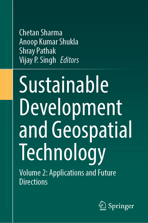
Sustainable Development and Geospatial Technology
Springer International Publishing (Verlag)
978-3-031-65702-3 (ISBN)
This two-volume set showcases the various ways in which geospatial technology can be used to achieve sustainable development goals across different sectors such as urban planning, natural resource management, agriculture, disaster management, and energy management. The books provide insights into the potential of geospatial technology in promoting sustainable development practices and addressing challenges related to climate change, environmental degradation, and socio-economic development. Both volumes together are a comprehensive guide that showcases the potential of geospatial technology in promoting sustainable development practices across different sectors, and will serve as an essential resource for professionals, policymakers, researchers, and students interested in sustainable development and geospatial technology.
Volume 2 explores practical applications, insightful case studies, and emerging trends within the dynamic intersection of sustainable development and geospatial technology. Delving into the critical domain of water resources and agriculture, it scrutinizes the application of geospatial tools in river basin management, integrated water resources management (IWRM), sustainable agriculture, and precision agriculture. The volume then shifts its focus to disaster management, energy, and the future, encompassing geospatial data science for disaster resilience, Earth observation for sustainable energy management, and diverse case studies that highlight the impact of geospatial technology on sustainable development. Moreover, it ventures into environmental monitoring and analysis, discussing topics like land use planning, climate change mitigation, environmental monitoring technology, and socioeconomic inequalities.
Dr Chetan Sharma
Dr. Chetan Sharma is a seasoned academician, researcher, and industry professional with over a decade of experience in civil and environmental engineering. Presently, working as Postdoctoral fellow at the University of Texas at San Antonio (UTSA), Dr. Sharma has continued to expand his research portfolio, focusing on AI modeling of complex karst aquifer systems and the impact of climate change on water availability. Holding a Ph.D. from the prestigious Indian Institute of Technology, Roorkee, Dr. Sharma's expertise lies in climate change impact assessment, artificial intelligence, machine learning models, stochastic hydrology, and sustainability measures. Dr. Sharma's commitment to research excellence is evident in his publication record, with the articles published in high-impact peer-reviewed journals, book chapters, and conference publications. He is also review editor for Frontiers in Climate research journal. He has reviewed more than 20 research articles, conference papers and book chapters. His research has garnered recognition from the scientific community, as reflected in his citation metrics and invitations to present his work at international conferences and symposiums. In addition to his academic pursuits, Dr. Sharma has actively engaged in industry collaborations and consultancy projects, bridging the gap between academia and real-world applications.
Beyond his research endeavors, Dr. Sharma is deeply committed to fostering the next generation of engineering professionals. He has served as a mentor and supervisor to numerous undergraduate and graduate students, guiding them in research projects and providing valuable insights into the field of civil and environmental engineering. Dr. Sharma's leadership qualities and collaborative spirit have also been recognized in various academic and professional settings. He has held positions of responsibility as the Head of Department at leading engineering institutions in India, where he played a pivotal role in curriculum development, faculty coordination, and student mentoring. In his pursuit of academic excellence, Dr. Sharma remains dedicated to lifelong learning and professional development. He actively participates in conferences, workshops, and training programs to stay abreast of the latest advancements in his field and to network with fellow researchers and practitioners.
Dr Anoop Kumar Shukla
Dr. Anoop Kumar Shukla is an Assistant Professor at Manipal School of Architecture and Planning (MSAP), Manipal Academy of Higher Education, Manipal, Karnataka, India. He holds eight years of research experience in Research & Development in Geomatics Engineering, Water and Wastewater Management, Remote Sensing, and Geographical Information Systems (GIS), as well as in Water Quality, Climate Change, Crop Yield Modelling, and related subjects. Dr. Shukla has published 25 high-impact journal papers, 35 International/National Conference papers, and 12 book chapters across ASCE, Wiley, and Springer publications. He is a member of various national and international academic, research, and administrative bodies including IAH, INCA, IEEE-GRSS, AGU, and ASCE.
He earned his M.Tech in Geomatics Engineering and Ph.D. in Remote Sensing and GIS applications in water resources planning and management from the Indian Institute of Technology Roorkee, Uttarakhand, India. Following this, he pursued a Post-doctoral fellowship (PDF) at the Institute of Geographic Sciences and Natural Resources Research (IGSNRR), Chinese Academy of Sciences (CAS), Beijing, China. Dr. Shukla serves as an Associate Editor for the Journal of Hazardous, Toxic, and Radioactive Waste (ASCE) and as a Review Editor on the Editorial Board of Water and Wastewater Management and Organic Pollutants Frontiers in Environmental Science journal. Dr. Shukla is a reviewer for more than 40 peer-reviewed international SCI journals.
1 Integrated Water Resources Management (IWRM) in the Geospatial Epoch.- 2 Exploring Opportunities of Generative Artificial Intelligence for Sustainable Soil Analytics in Agriculture.- 3 Mapping of Groundwater Potential Zones Using Multi-Criteria Decision Making and Overlay Analysis.- 4 Global High-Resolution Hydro-Meteorological Variables Distribution Patterns.- 5 A Review on Application of GIS for the Assessment of Geo-Spatial Extent and Concentration of Environmental Occurrence and Impacts of Mercury Pollution.- 6 Spatial and Temporal Planform Study of River Godavari between Polavaram and Dowleswaram Bridge.- 7 Remote Sensing.- 8 Sustainability Considerations in Recent Advances of Numerical Techniques for Investigating Slope Stability.- 9 Reviewing Slope Stability Integration in Disaster Management and Land Use Planning.- 10 Quantitative Geospatial Analysis of Sedimentation Rates in Bhadar Reservoir through Advanced Remote Sensing & GIS Techniques.- 11 Application of Remote Sensing in Natural Resource Management.- 12 Harnessing Geospatial Approaches in Air Quality Mapping and Monitoring.- 13 Optimal Site Selection of Treatment Facilities and Landfill Zones for Municipal Solid Waste Disposal in Jodhpur, India using GIS and MCDA.- 14 Strategies and Implementation for Achieving Sustainable Flood Risk Management.- 15 Smart Cities and Geospatial Solutions.- 16 Applying Shadow Removal Technique for Urban Area Identification on High-resolution Aerial/Satellite Images Using Color Information and Deep Learning.
| Erscheinungsdatum | 28.09.2024 |
|---|---|
| Zusatzinfo | XII, 272 p. 88 illus., 82 illus. in color. |
| Verlagsort | Cham |
| Sprache | englisch |
| Maße | 155 x 235 mm |
| Themenwelt | Naturwissenschaften ► Biologie ► Ökologie / Naturschutz |
| Naturwissenschaften ► Geowissenschaften ► Geografie / Kartografie | |
| Schlagworte | geographic information systems • Geospatial Data • natural resource management • sustainable development • urban planning |
| ISBN-10 | 3-031-65702-0 / 3031657020 |
| ISBN-13 | 978-3-031-65702-3 / 9783031657023 |
| Zustand | Neuware |
| Haben Sie eine Frage zum Produkt? |
aus dem Bereich


