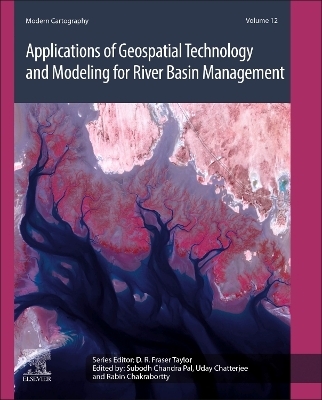
Applications of Geospatial Technology and Modeling for River Basin Management
Elsevier - Health Sciences Division (Verlag)
978-0-443-23890-1 (ISBN)
Subodh Chandra Pal is an Assistant Professor in Department of Geography at The University of Burdwan, India. He received his Ph.D. in Geography from Visva-Bharati (Central University in India) in 2015. His main fields of expertise are fluvial geomorphology, pedo-geomorphology, land degradation, soil erosion, gully erosion, landslide vulnerability, climate change, water resources monitoring and management and published nearly two hundred international and national research articles in various renowned journals. He has authored a book on Climate Change Impact on Soil Erosion in Sub-tropical Environment: Application of Empirical and Semi-empirical Models. He is the Editor of four running Edited books and is also an Editorial board member of MDPI Water and Frontiers of Earth Science journals. His research work has been funded by the University Grants Commission (UGC) and Department of Science and Technology (DST), Govt. of India. Dr. Pal has served as a reviewer for many International reputed journals. Since 2022, Stanford University has recognized Dr. Pal as one of the world's top 2% scientists Dr. Uday Chatterjee is an Assistant Professor at Bhatter College in Dantan, Paschim Medinipur, West Bengal, India, and an Applied Geographer with a Post-Graduate in Applied Geography from Utkal University and a Doctorate in Applied Geography from Ravenshaw University in Cuttack, Odisha. He has contributed to a number of research papers that have been published in reputable national and international publications, as well as edited book volumes. He has also organized (as the convener) a Faculty Development Program on "Modern ways of teaching and advanced research methods," which was funded by the Indian Council of Social Science Research (ICSSR). Urban Planning, Social and Human Geography, Applied Geomorphology, Hazards & Disasters, Environmental Issues, Land Use and Rural Development are some of his research interests. The West Bengal Pollution Control Board (WBPCB) of the Government of West Bengal, India, financed his research. He has worked as a reviewer for a number of international publications. Dr. Uday Chatterjee is currently the lead editor of the Springer Special Issue (S.I) on Urbanism, Smart Cities, and Modelling. Rabin Chakrabortty, is a senior research fellow in the Department of Geography at the University of Burdwan. His main research interests are spatial mapping, modeling and management of natural hazards and natural resources like soil, water, land and forest with emphasis on clime change. He has published more than eighty international and national research articles in various renowned journals like Springer, Elsevier and Taylor & Francis group.
1. Recent land use land cover changes, demographic transition and rainfall trends in a middle Himalayan watershed
2. Hypsometric Analysis for Erosion Susceptibility of Karnaphuli Watershed, Bangladesh, using Remote Sensing and GIScience
3. Impact analysis of the 2022 flood event in Sylhet and Sunamganj using Google Earth Engine
4. Geographical Appraisal of Basin Hydrological Phenomenon Using Google Earth Engine
5. Arsenic enrichment in groundwater mechanism through hydro-geochemical control, mobilization and sorption in the lower Gangetic basin in West Bengal
6. Geo-Spatial Technique Based Flood Hazard Assessment and Mapping: A Case Study of Orang National Park, Assam, India
7. Anatomization of Flood Risk and Vulnerability using AHP and Frequency Ratio in Dibrugarh District of Assam, India
8. Quantifying Land use / land cover dynamics and fragmentation analysis along the stretch of Bhagirathi River in Murshidabad District, West Bengal
9. 2D hydro-numeric flood modelling using open-source software QGIS and freeware BASEMENT (V3) on a section of the Elbe River in Magdeburg, Germany
10. Drought monitoring using a water scalar index
11. Agricultural Drought Monitoring Using Google Earth Engine: A Study of Paschim Medinipur District, West Bengal
12. Geo-Spatial and Statistical Techniques of Regionalization for River Basin Management
13. Analysis of Watershed Attributes for Water Resource Management Using Geospatial Technology: A Case Study of Haringmuri Watershed
14. Ecological and Economical Services of Coastal Landscape: A Case Study on Ramnagar-I and II Block, Purba Medinipur, West Bengal, India
15. Comparative study of remote sensing derived indices for meteorological and agricultural drought monitoring in GIS environment: A review
16. GIS-based Statistical Mapping of Socio-economic Vulnerability in the Upper Citarum River, West Java Province, Indonesia
17. Assessing the impact of channel migration and bank erosion on the loss of agricultural land and LULC change in the lower course of Kankai Mai River - a geospatial approach
18. Geo-spatial modeling of Potential soil erosion estimation for sustainable soil conservation planning and management
19. Assessment of Riverbank Erosion and Its Prediction using Geospatial and Machine learning Techniques
20. Impact of soil erosion and resultant sediment yield on different stream orders
21. Prediction of gully erosion vulnerability using geospatial tools and machine learning algorithms: A critical review
22. Community Preferences in the Adaptation of River Neighbourhood at Skudai River, Malaysia
23. Estimation of soil erosion risk and vulnerable zone using RUSLE and GIS approaches
24. Monitoring of Land Degradation and Desertification using the state-of-the-art methods and remote sensing data
25. Impact of rapid urbanization on groundwater environment: A geospatial analysis with special reference to Bolpur-Sriniketan C.D. Block Of Birbhum District in lower Ajay river basin since last decade
26. Water management sustainability evaluation at the river basin level: concept, methodology, and application
27. A Machine Learning Methodology to Calculate the Percentage of Areas Affected by Drought in Brazil in Map Images
| Erscheinungsdatum | 03.09.2024 |
|---|---|
| Reihe/Serie | Modern Cartography Series |
| Verlagsort | Philadelphia |
| Sprache | englisch |
| Maße | 191 x 235 mm |
| Gewicht | 450 g |
| Themenwelt | Naturwissenschaften ► Biologie ► Ökologie / Naturschutz |
| Naturwissenschaften ► Geowissenschaften ► Geografie / Kartografie | |
| Naturwissenschaften ► Geowissenschaften ► Geologie | |
| Naturwissenschaften ► Geowissenschaften ► Hydrologie / Ozeanografie | |
| ISBN-10 | 0-443-23890-1 / 0443238901 |
| ISBN-13 | 978-0-443-23890-1 / 9780443238901 |
| Zustand | Neuware |
| Haben Sie eine Frage zum Produkt? |
aus dem Bereich


