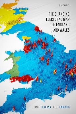
The Changing Electoral Map of England and Wales
Oxford University Press (Verlag)
978-0-19-284795-9 (ISBN)
The 2019 British general election saw a dramatic redrawing of the electoral map, with the Labour Party losing seats to the Conservatives in former heartlands in the North of England and Midlands. Yet this had been a long-term shift, with the opposite trend occurring in major cities and university towns, where Labour's support has been increasing. What has driven these changes in electoral geography? Why do they matter? This book offers a definitive account of the changing electoral geography of England and Wales over the past half century. Jamie Furlong and Will Jennings argue that long-term trends in social and economic structure have significantly altered the spatial distribution of voters and, combined with changes in the parties' appeal to those voters, have led to a gradual, though recently accelerating, realignment of the geographical basis of electoral competition.
Constituency-level analysis of voting at general elections between 1979 and 2019 reveals a swing from Labour to the Conservatives in demographically 'left behind' areas (areas with largely white, working-class populations and lower levels of educational attainment), while Labour's support has remained stable in areas characterized by high levels of economic deprivation and insecure employment. Areas that have experienced improvements in their socioeconomic condition - typically cities where Labour have inefficiently stacked up votes - have swung towards Labour, whereas areas characterized by economic and population decline have swung towards the Conservatives. Spatial analysis reveals clusters of seats where each party has more support than expected based on sociodemographic composition - places where, in short, place matters. In Merseyside, Labour's vote is much higher than would be predicted by demographics, while this is similarly the case for the Conservatives in Lincolnshire and parts of the West Midlands. But what makes these areas distinctive? We present qualitative case studies for Merseyside and Lincolnshire to identify the place-based, contextual factors that help explain their unusual political characteristics. The book argues for the need to recognize the importance of people, places, and parties in shaping the geography of electoral outcomes.
Jamie Furlong is a Research Fellow at the University of Westminster, where he is currently involved in quantitative research aiming to understand the impact of Low Traffic Neighbourhoods in London and across the UK. Previously, he worked at the Labour Party HQ initially as a Targeting Analyst and then as Targeting and Analysis Manager. This followed on from a PhD in Social Statistics at the University of Southampton studying changes in British electoral geography, which served as his inspiration for this book. He has broad research interests spanning human geography: from urban, environmental, and social policy to political, economic, and electoral geography. Will Jennings is Professor of Political Science and Public Policy at the University of Southampton and Elections Analyst for Sky News. He has held Research Fellowships at the University of Manchester and the London School of Economics and Political Science and completed his doctorate at the University of Oxford. He specializes in the study of public opinion and public policy. His books include Olympic Risks (Palgrave Macmillan, 2012), The Politics of Competence: Parties, Public Opinion and Voters (with Jane Green; CUP, 2017), and The British General Election of 2019 (with Robert Ford, Tim Bale, and Paula Surridge; Palgrave Macmillan, 2021).
List of Figures
List of Tables
1: Redrawing the electoral map
2: How changing demography drives electoral change
3: Electoral change in England and Wales
4: How places vote
5: Relative decline (and growth) and the changing electoral geography of England and Wales
6: In search of Red and Blue heartlands
7: Why place matters: Insights from Merseyside and Lincolnshire
8: Conclusion
References
| Erscheinungsdatum | 22.08.2024 |
|---|---|
| Verlagsort | Oxford |
| Sprache | englisch |
| Maße | 160 x 240 mm |
| Gewicht | 614 g |
| Themenwelt | Naturwissenschaften ► Geowissenschaften ► Geografie / Kartografie |
| Sozialwissenschaften ► Politik / Verwaltung ► Staat / Verwaltung | |
| ISBN-10 | 0-19-284795-3 / 0192847953 |
| ISBN-13 | 978-0-19-284795-9 / 9780192847959 |
| Zustand | Neuware |
| Haben Sie eine Frage zum Produkt? |
aus dem Bereich


