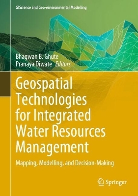
Geospatial Technologies for Integrated Water Resources Management
Springer International Publishing (Verlag)
978-3-031-57776-5 (ISBN)
This book examines water resources, helps understand complexities in water management, and explains the use of geospatial technology. By 2050, the world will have nearly about 9.8 billion population and which is almost 2.5 to 3 billion added to the present population. Only 3% of world water resources are available for human consumption. Even some resources are polluted because of poor management. Water management is important since it helps determine future irrigation prospects. Management of water resources under set policies and regulations. Water is a more valuable commodity and the world is facing acute water shortages because of drought which is attributed to climate change and overuse. Many rivers are drying up, polluted and encroached.
Now the challenge is whether future generations will have enough fresh water for living. Geospatial Technology i.e. Remote Sensing (RS) and GIS have gained considerable interest among earth and hydrological science communities for solving and understanding various complex issues and approaches towards water resources development and management. Water can provide sustainability to any region. Sustainability means that meet the needs of the present, without compromising the ability of future generations to meet their own needs. These are generally integrated to study a variety of natural resources and their characteristics. Major advancements have been accomplished in integrating remote sensing and GIS and they complement each other. RS is used for acquiring information for GIS. Remote sensing and GIS integration provide information on the spatial variation, extent, and potential and limitations of natural resources, which is essential for planning the strategy for sustainable development. Most hydrological or geomorphological models are developed in a GIS framework and these are helpful for the planning and management of water and decision-makers for sustainable development.
Dr. Bhagwan B. Ghute is an Assistant Professor at the Department of Geology, Toshniwal Arts, Commerce, and Science College, Sengaon, Dist. Hingoli (Maharashtra), India. He has been working there since 2011. Dr. Ghute completed his B.Sc. and M.Sc. in Geology from Swami Ramanand Teerth Marathwada University in Nanded in 2006 and 2008, respectively, with first-class. He has been awarded Dr. Bhimrao Pingale first merit award during his M.Sc. geology. In December 2010, he secured the first rank from Maharashtra for the State Eligibility Test for the Earth, Atmospheric, Ocean, and Planetary Sciences for the lectureship. Swami Ramanand Teerth Marathwada University, Nanded, recognized him as a Post-Graduate (PG) teacher and Ph.D. Research supervisor. Dr. Ghute has completed two MRPs funded by Swami Ramanand Teerth Marathwada University, Nanded, and Rajiv Gandhi Science and Technology Commission, Mumbai. He is a life member of various societies and Journals and was nominated as a Member of the Board of Studies in Geology at SRTM University for 2023-2027. His primary research areas include Quaternary geology, groundwater, remote sensing, and GIS. Dr. Ghute has published more than 25 research papers in national and international journals.
Dr. Pranaya Diwate is currently working as an Assistant Professor at UDBAS, MGM University, Chhatrapati Sambhaji Nagar (Maharashtra). He previously worked as an Assistant Professor at the Centre for Climate Change and Water Research, Suresh Gyan Vihar University, Jaipur. He is also working as a MANAGING EDITOR at International Journal of Suresh Gyan Vihar University of Climate Change. He did his Ph.D. degree in Earth Sciences from the Wadia Institute of Himalayan Geology Dehradun (DST Autonomous Institute) and the University of Jammu, Jammu, in 2020. He has more than 30 research publications, including research papers, and book chapters. He has more than 8 years of research and teaching experience working in the area of Climate change, Water resources, Paleoclimatology, Remote Sensing and GIS etc. He has attended and organized around 26 national and international conferences. He has completed several national and international certification courses from University of Geneva, Switzerland, University of Colorado, Boulder, Colorado, United States and American Museum of Natural History etc. He was also course coordinator of different modules of EDUSAT based distance learning program organized by IIRS (Indian Institute of Remote Sensing), ISRO (Indian Space Research Organization), Govt. of India. He was also awarded a research award and an INSPIRE fellowship.
Waterlogging and flood hazards vulnerability and risk assessment in the Harayana , India.- Spatial-Temporal Trends of Rainfall, Inflow and Runoff in the Wainganga River Basin, India using Remote Sensing and GIS.- Delineation of Groundwater Potential Zone Using Geospatial Techniques for Bilaspur District, Himachal Pradesh (India).- Spatio-temporal variability and trend analysis of rainfall in Kanhar River Basin, and forecasting using state-space models.- Drought risk assessment and prediction using artificial intelligence over the Marathwada and Vidarbha Region, Maharashtra.- Flood Vulnerability Analysis of the part of Karad Region, Satara District, Maharashtra using Remote Sensing and Geographic Information System technique.- Water resource management using geospatial technology: A review.- Mapping Prospective Areas of Water Resources and Monitoring Land Use/Land Cover Changes in an Uttarakhand Region Using Remote Sensing and GIS Techniques.- Application of Geospatial technology for wetland management and restoration.- Remote sensing and GIS techniques for selecting a sustainable scenario for Lake from Himalayan Region, India.- Factors influencing groundwater quality: towards an integrated management approach for sustainable management.- Eutrophication modeling of freshwater reservoirs using remote sensing and GIS.- Monitoring & management of surface water resources using Remote sensing and GIS.- Meso to micro watershed level morphometric analysis of Vaidarbha river basin.- The groundwater prospects map and development of geospatial database of watersheds in Aundha tahasil, Maharashtra.- Assessment of climate change impact on Groundwater resources in Kayadhu river basin, Maharashtra, India.- Assessment of land degradation susceptibility using geospatial analysis by using AHP: A case study.- Modeling and accessing of soil erosion using geospatial techniques.- Assessment of groundwater quality of coastal aquifers in renowned area for cultivation of betal nut and coconut, Guhagar.- Phonological assessment of water for better yield predication: - Machin meaning approach.- Water management system for better crop yield predictions using Internet of things (IoT).- Groundwater resource management studies in Sahyadri group and Satpura group of Deccan traps: a comparative study of representative watersheds from the Nandurbar district of Maharashtra, india.- Spatiotemporal modeling for evaluation of groundwater quality and its suitability for potable uses in Lucknow city, India.- Study of physical properties groundwater assessment in Ratnagiri district, Maharashtra.- Microplastics pollution and its impacts on fresh water resource - A lentic ecosystem.- Geospatial technological applications in integrated geological study of Nandurbar district in geo-tourism perspective.- Delineation of groundwater potential zones in Jharia coal Mining Region using Geostatistics, Remote sensing and GIS techniques.
| Erscheinungsdatum | 18.07.2024 |
|---|---|
| Reihe/Serie | GIScience and Geo-environmental Modelling |
| Zusatzinfo | XXII, 294 p. 133 illus., 122 illus. in color. |
| Verlagsort | Cham |
| Sprache | englisch |
| Maße | 178 x 254 mm |
| Themenwelt | Naturwissenschaften ► Geowissenschaften ► Geografie / Kartografie |
| Schlagworte | climate change • Flood management • geomorphology • Geospatial Technology • Groundwater Mapping • groundwater modelling • Policies and Regulations • water resources |
| ISBN-10 | 3-031-57776-0 / 3031577760 |
| ISBN-13 | 978-3-031-57776-5 / 9783031577765 |
| Zustand | Neuware |
| Haben Sie eine Frage zum Produkt? |
aus dem Bereich


