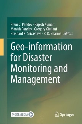
Geo-information for Disaster Monitoring and Management
Springer International Publishing (Verlag)
978-3-031-51052-6 (ISBN)
The objective of this publication is to provide insight into advancing remote sensing techniques dealing with floods, droughts, landslides, earthquakes, permafrost-related hazards, glacial lake outburst floods, forest fires, droughts, tropical cyclones, climate resilience and COVID-19. This publication will incorporate the latest technologies and techniques to illustrate disaster monitoring for acquiring information and dissemination of technological results and outcomes for the betterment of society. This publication would be of immense importance for earth scientists, policymakers and professionals working in the field of disaster risk reduction.
Dr. Prem C. Pandey received PhD from University of Leicester, United Kingdom He did his Post-Doctoral from Tel Aviv University Israel. Currently, he is working as Assistant Professor in Department of Life Sciences, School of Natural Sciences, Shiv Nadar University, UP India. Previously, he has been associated with IESD, Banaras Hindu University India. He received his M.Sc. in Environmental Sciences and M.Tech. in Remote Sensing. He worked on remote sensing applications as Professional Research funded by NRSC Government of India. He has been a recipient of several awards including Commonwealth UK, INSPIRE, MHRD and UGC fellowships, SERB-NPDF from GoI India. He has published >55 peer reviewed journal articles, 7 Edited Books, several book chapters and presented his work in several conferences. Additionally, he is also a member of Indian Society of Geomatics, Indian Society of Remote Sensing, IUCN-CEM, SPIE and AAG. He is also acting as editorial Board members of Geocarto International (T & F), Sustainable Development WILEY (IF 12.5), and serving as Guest editor for Remote Sensing, MDPI. He is having an expertise in remote sensing of environment research themes: his research interests include natural resource including forestry, agricultural, urban studies and environmental pollutant modeling.
Dr. Rajesh Kumar successfully defended his Ph.D. (Geography) on 'Fluvial Processes in Lower Rapti River Basin: A Case Study of Impacts on Arable Land' from the CSRD, JNU in 2011. He was awarded Junior Research Fellowship (JRF) in 2009 by the University Grant Commission (UGC), New Delhi. He worked as Research Associate in the Ministry of Environment, Forest and Climate Change (MoEFCC), Govt. of India (GoI)- sponsored project on 'Ganga River Basin Management Plan' in collaboration with School of Environmental Sciences, JNU and IIT Kanpur during October 2011 -July 2013. Further, he joined the CSRD as Research Associate and worked in the Department of Science (DST), GoI-sponsored project on 'Geomorphological and Chronostratigraphic Reconstruction of Glacial Episodes of Gangotri Glacier in Bhagirathi Basin, NW Garhwal Himalaya' from August 2013 to August 2014. He is actively involved in research and wrote 16 research papers/book chapters/Atlas, published by national and international publishers. His major research areas are related to applications of geospatial technology in river science. His research papers are related to the anthropocene epoch of geological time scale dealing with the impact of human activities on rivers and climate-related disasters.
Dr. Manish Pandey currently works at the University Center for Research & Development (UCRD), Chandigarh University located in Mohali, Punjab, India. He earned his graduation (Geography honors) and post-graduation (geography) from University of Allahabad, located in Allahabad, Uttar Pradesh, India. He has been awarded research grant as Junior Research Fellow (JRF) and Senior Research Fellow (SRF) for carrying out his doctoral research by the Council of Scientific and Industrial Research (CSIR), Ministry of Human Resource Development, Government of India. After earning his Ph.D. degree in the field of geomorphology, he has been engaged in post-doctoral research (at different research positions) for more than 5 years. His research interests are in Geography, Fluvial and Glacial Geomorphology, Glaciology and Remote Sensing & Geoinformatics (GIS). His simple interest is in understanding the process-form relationship in diverse environmental settings. He is an experienced research associate with a demonstrated capability of working in the research industry, skilled in cartography, geomorphology, well versed in GIS packages like ArcGIS, QGIS, ERDAS Imagine, and Data Analysis, and Strong research professional with a Doctor of Philosophy (Ph.D.) in Fluvial Geomorphology from Banaras Hindu University. His exposure to glaciological field work
Introduction.- Landslide/ Slope failures/ Flood and glacial lake outburst floods (GLOFS) /Drought/ Desertification status mapping/ Tsunami/ Lightening/ Forest Fire/ Earthquake / Volcanic eruptions.- Statistical, multi-criteria decision making (MCDM), machine learning models (spatial prediction models).- Challenges and future needs.
| Erscheinungsdatum | 24.05.2024 |
|---|---|
| Zusatzinfo | XXXVII, 517 p. 203 illus., 192 illus. in color. |
| Verlagsort | Cham |
| Sprache | englisch |
| Maße | 155 x 235 mm |
| Themenwelt | Naturwissenschaften ► Biologie ► Ökologie / Naturschutz |
| Naturwissenschaften ► Geowissenschaften ► Geologie | |
| Schlagworte | disaster management • GIS monitoring • hazard mapping • natural hazard mapping • risk assessment • Susceptibility mapping |
| ISBN-10 | 3-031-51052-6 / 3031510526 |
| ISBN-13 | 978-3-031-51052-6 / 9783031510526 |
| Zustand | Neuware |
| Haben Sie eine Frage zum Produkt? |
aus dem Bereich


