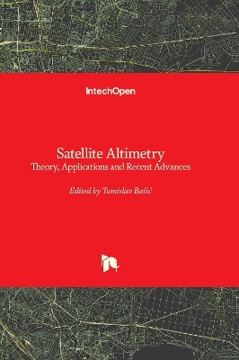
Satellite Altimetry
Theory, Applications and Recent Advances
Seiten
2023
IntechOpen (Verlag)
978-1-80355-879-0 (ISBN)
IntechOpen (Verlag)
978-1-80355-879-0 (ISBN)
Satellite radar altimetry has become a key spatial technique for observing the ocean surface as well as many aspects of the land surface. During the last more than three decades, satellite altimetry has revolutionized the geosciences, enabling a much better understanding of the Earth’s sea level and its changes over time.
Satellite radar altimetry, as one of the basic space measurement techniques intended primarily for solving global geoscientific tasks by means of radar measurements from satellites towards the Earth, has become, primarily due to its accuracy, a key spatial technique for observing the ocean surface as well as many aspects of the land surface. During the last more than three decades, satellite altimetry has revolutionized the geosciences, especially oceanography, geophysics, and geodesy, enabling a much better understanding of the shape of the Earth’s sea level and its changes over time. In this way, it is possible to monitor natural- and human-induced changes in the balance of water masses. For researchers in the field of geosciences, satellite radar altimetry ensures the collection of high-precision global data of uniform accuracy on sea level and therefore is essential for quality unification of vertical height systems, regional and global geoid and gravity, as well as bathymetry modelling, monitoring the impact of sea level rise as well as the vertical movement of the Earth’s crust in coastal areas, ice melting detection, and more, all of which have a significant impact on climate and environmental studies. This book provides an up-to-date overview of the technology itself and some recent developments in using altimeter data to determine sea-level changes and sea-level variability, modelling marine bathymetry from satellite altimeter-derived gravity data, including the related issue of solving terrain corrections for gravity reduction, as well as the possibility of applying artificial intelligence in the monitoring of Earth’s changes.
Satellite radar altimetry, as one of the basic space measurement techniques intended primarily for solving global geoscientific tasks by means of radar measurements from satellites towards the Earth, has become, primarily due to its accuracy, a key spatial technique for observing the ocean surface as well as many aspects of the land surface. During the last more than three decades, satellite altimetry has revolutionized the geosciences, especially oceanography, geophysics, and geodesy, enabling a much better understanding of the shape of the Earth’s sea level and its changes over time. In this way, it is possible to monitor natural- and human-induced changes in the balance of water masses. For researchers in the field of geosciences, satellite radar altimetry ensures the collection of high-precision global data of uniform accuracy on sea level and therefore is essential for quality unification of vertical height systems, regional and global geoid and gravity, as well as bathymetry modelling, monitoring the impact of sea level rise as well as the vertical movement of the Earth’s crust in coastal areas, ice melting detection, and more, all of which have a significant impact on climate and environmental studies. This book provides an up-to-date overview of the technology itself and some recent developments in using altimeter data to determine sea-level changes and sea-level variability, modelling marine bathymetry from satellite altimeter-derived gravity data, including the related issue of solving terrain corrections for gravity reduction, as well as the possibility of applying artificial intelligence in the monitoring of Earth’s changes.
| Erscheinungsdatum | 08.11.2023 |
|---|---|
| Verlagsort | London |
| Sprache | englisch |
| Maße | 178 x 254 mm |
| Themenwelt | Naturwissenschaften ► Geowissenschaften ► Geologie |
| ISBN-10 | 1-80355-879-2 / 1803558792 |
| ISBN-13 | 978-1-80355-879-0 / 9781803558790 |
| Zustand | Neuware |
| Haben Sie eine Frage zum Produkt? |
Mehr entdecken
aus dem Bereich
aus dem Bereich


