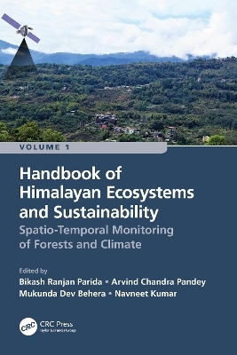
Handbook of Himalayan Ecosystems and Sustainability, Volume 1
CRC Press (Verlag)
978-1-032-21430-6 (ISBN)
Volume 1: Spatio-Temporal Monitoring of Forests and Climate is aimed to describe the recent progress and developments of geospatial technologies (remote sensing and GIS) for assessing, monitoring and managing fragile Himalayan ecosystems and their sustainability under climate change. It is a collective research contribution from renowned researchers and academicians working in the Hindu Kush Himalayan (HKH) mountain range. The Himalayas ecosystems have been facing substantial transformation due to severe environmental conditions, land transformation, forest degradation and fragmentation. The authors utilized satellite datasets and algorithms to discuss the intricacy of land use/land cover change, forest and agricultural ecosystems, canopy height estimation, above-ground biomass, wildfires, carbon sequestration, and landscape restoration. Furthermore, the potential impacts of climate change on ecosystems, biodiversity and future food and nutritional security are also addressed including the impact on the livelihood of people of the Himalayas. This comprehensive Handbook explains the advanced geospatial technologies for mapping and management of natural resources of the Himalayas.
Key Features
Explains multiple aspects of geospatial technologies for studying fragile Himalayan ecosystems and sustainability
Focuses on the utility of interferometric synthetic aperture radar (SAR) modeling for canopy height
Explain how remote sensing techniques are useful for deriving the above-ground biomass, gross primary productivity (GPP), and carbon fluxes
Addresses how geospatial technologies are valuable for understanding vegetation dynamics, composition and landscape restoration due to shifts in timberline and forest fires
Includes contributions from global professionals working in the HKH mountain range
Readership
The Handbook serves as a valuable reference for students, researchers, scientists, ecologists, agricultural scientists, meteorologists, decision makers and all others who wish to advance their knowledge on vegetation remote sensing considering climate change in the HKH region.
Bikash Ranjan Parida is an assistant professor at Central University of Jharkhand (CUJ), India since September 2016. He earned his M.Sc. in Geoinformatics (2006) from the University of Twente and his PhD from the University of Hamburg/ Max Planck Institute for Meteorology (2011). Prior to joining CUJ, he was employed by various premium institutes involved in Earth and Environmental studies He has contributed to several national research projects such as Science and Engineering Research Board (SERB) under the Department of Science and Technology (DST), Start-Up Research Grant by UGC, NISAR project by SAC, Ahmedabad, ISRO. He has more than 40 research publications in peer-reviewed journals. A.C. Pandey is a professor in the Department of Geoinformatics at Central University of Jharkhand (CUJ), India. He is the former Head of the Department of Geoinformatics (2013-2020) and the former Dean of the School of Natural Resource Management (2013-2016) at CUJ. He has been the CUJ Coordinator for ISRO and EDUSAT program since 2013. From 2004-2013 he was an associate professor of Remote Sensing in Birla Institute of Technology. He earned his Ph.D. degree in Geology from Department of Geology at the University of Delhi in 2001. He has published more than 70 articles and two edited books. He is the recipient of NASA-SERVIR Fellowship in 2013 to work on Himalayan glaciers in Zanskar Valley, J&K. Mukunda Dev Behera has made outstanding contributions to the fields of forest remote sensing and ecological climatology. His research innovations have fundamentally transformed the study of phytogeography, with attention to ecological functioning of three ecosystem components, plant diversity-water-energy. Dr. Behera has been a Guest Editor for six special issues and has served in three editorial boards of Springer’s journals: Biodiversity and Conservation, Environmental Monitoring and Assessment, and Tropical Ecology. With over 20-year research and teaching experience, he has published over 100 articles. Navneet Kumar is a senior researcher at the Center for Development Research (ZEF), University of Bonn in Germany. He earned his PhD in Engineering from the University of Bonn. His main research fields are water and natural resources management and Geoinformatics. Dr. Kumar has contributed to several projects in Algeria, Ethiopia, India, Mali, Niger and Uzbekistan. These projects include research on the impact assessment of climate change and land use change. He has presented his work in several international conferences and has published with several journals.
Introduction to Himalaya. Section 1- Geospatial Perspective for Monitoring Himalayan Ecosystem. Monitoring Land Use and Land Cover Dynamics Across the Himalayas from 1985 to 2019. Assessment of the Effects of LULC Changes on Surface Temperature. Shifting Cultivation Dynamics of Northeastern India. Monitoring Tea Plantations Dynamics (2000–2020) Using Satellite Data in Dooars Regions of Himalaya. Disentangle the Short and Long -Term Forest Degradation Over Most Fire Affected Parts of Western Himalaya, India. Potential of Spaceborne Bistatic Polarimetric Interferometric SAR Modelling for Vegetation Height Estimation. Section 2 – Monitoring Vegetation Productivity and Climate Change. Estimating Aboveground Biomass of Sal and Teak Forests Using Terrasar-X and Semi-Empirical Model in Part of Terai Himalaya. Spatial Distribution of GPP Over Croplands Using Planetscope Imagery in Majuli Islands, Assam. Vegetation Trend Analysis and Seasonal Change Estimation Based on Time-Series Satellite Data for Northeast India. Century-Scale Variations in Vegetation Greenness and Productivity in Central Himalaya. Climatic Control of High-Latitude Vegetation Monotonic Greening and Browning Trends Across the Himalayas and Anthropogenic Effect. Climate Forcing on Photosynthetic Variability Across Relief Zones in the Himalayas. Section 3 - Forest Fire and Landscape Restoration. Appraisal of Forest Fire Risk Through Geospatial Techniques in Uttarakhand Himalayan Region. Changing Pattern of Forest Fire Regime in Relation to Climatic Oscillation Over Western and Eastern Himalaya, India. Forest Fuel Bed Mapping in Sikkim Himalaya. Floristic Shifting of Endemic Species in Eastern Himalayas due to Climate Change. Landscape Restoration in Indian Himalayan Region.
| Erscheinungsdatum | 10.06.2022 |
|---|---|
| Zusatzinfo | 65 Tables, black and white; 93 Line drawings, color; 16 Line drawings, black and white; 23 Halftones, color; 4 Halftones, black and white; 116 Illustrations, color; 20 Illustrations, black and white |
| Verlagsort | London |
| Sprache | englisch |
| Maße | 156 x 234 mm |
| Gewicht | 730 g |
| Themenwelt | Naturwissenschaften ► Biologie ► Ökologie / Naturschutz |
| Naturwissenschaften ► Geowissenschaften ► Geografie / Kartografie | |
| Weitere Fachgebiete ► Land- / Forstwirtschaft / Fischerei | |
| ISBN-10 | 1-032-21430-9 / 1032214309 |
| ISBN-13 | 978-1-032-21430-6 / 9781032214306 |
| Zustand | Neuware |
| Informationen gemäß Produktsicherheitsverordnung (GPSR) | |
| Haben Sie eine Frage zum Produkt? |
aus dem Bereich


