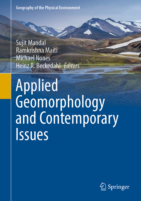
Applied Geomorphology and Contemporary Issues
Springer International Publishing (Verlag)
978-3-031-04531-8 (ISBN)
Section I: Climate Change and Rivers Response.- Large-scale sediment transport modelling: development, application, and insights.- An Appraisal to Anthropogeomorphology of the Chel River basin, Outer Eastern Himalayas and foreland, West Bengal, India.- Channel Migration Vulnerability in the Kaljani River basin of Eastern India.- Exploring change of river morphology and water quality in the stone mine areas of Dwarka River Basin, Eastern India.- An attempt to forecast seasonal precipitation in the Comahue River basins (Argentina) to increase productivity performance in the region.- Channel Instability in Upper Tidal Regime of Bhagirathi-Hugli River, India.- The pattern of extreme precipitation and river-runoff from gauge data in Eastern Nepal.- Climate change and its impact on catchment linkage and connectivity.- Inter-decadal variability of precipitation patterns increasing the runoff intensity in Lower reach of Shilabati River basin, West Bengal.- Section II: Land degradation, Resource Depletion and Livelihood Challenges.- Are the badlands of Tapi Basin in Deccan Trap Region of India "Vanishing Landscape.- Soil Piping: Problems and Prospects.- Role of LU & LC types on the spatial distribution of Arsenic contaminated tube wells of Purbasthali I & II Blocks of Burdwan District, West Bengal, India.- Forecasting the danger of the forest fire season in north-west Patagonia, Argentina.- Quantifying the Spatio-seasonal Water Balance and Land Surface Temperature Interface in Chandrabhaga River Basin, Eastern India.- Application of ensemble machine learning models to assess the sub-regional groundwater potentiality: a GIS-based approach.- Enhancement of natural and technogenic soils through sustainable soil amelioration products for a reduction of aeolian and fluvial translocation processes.- Assessment of land use and land cover change in the Purulia district, India using LANDSAT data.- "Prioritization of Watershed Developmental Plan by the Identification of Soil Erosion Prone Areas using USLE & RUSLE Methods for Sahibi Sub-Watershed of Rajasthan and Haryana state, India".- Estimation of soil erosion using Revised Universal Soil Loss Equation (RUSLE) Model in Subarnarekha River Basin, India.-Land Cover Changes in Green Patches and its Impact on Carbon Sequestration in an Urban System, India.- Review on Sustainable Groundwater Development and Management Strategies Associated with the Largest Alluvial Multi-Aquifer Systems of Indo-Gangetic Basin in India.- Section III: Large Dams and River Systems.- Predicting the distribution of farm dams in rural South Africa using GIS and remote sensing.- Large Dams, Upstream Responses, and Riverbank Erosion: Experience.- Section IV: Climate Change, Geomorphic Hazards and human livelihood.- Climate Change and Human Performance: Assessment of Physiological Strain in Male Paddy Cultivators in Hooghly, West Bengal, India.- Study on Climate change and its impact on coastal habitats with special reference to ecosystem vulnerability of the Odisha coastline, India.- The Millennium Flood of the Upper Ganga Delta, West Bengal, India: A Remote Sensing Based Study.- Tropical Cyclone: A Natural Disaster with special reference to Amphan.- Observed changes in the precipitation regime in the Argentinean Patagonia and their geographical implication.- An assessment of severe storms, their impacts and social vulnerability in coastal areas: A case study of General Pueyrredon, Argentina.- Modelling and mapping landslide susceptibility of Darjeeling Himalaya using geospatial technology.- Climate change induced coastal hazards and community vulnerability in Indian Sundarban.- Sea-level changes along Bangladesh coast: how much we know about it?.- Assessing channel migration, bank erosion vulnerability and suitable human habitation sites in the Torsa River Basin of Eastern India using AHP model and geospatial technology.-Spatiotemporal Assessment of Drought Intensity and Trend Along With Change Point: A Study on Bankura District, West Bengal, India.- Landslide susceptibility assessment and management using advanced hybrid machine learning algorithms in Darjeeling Himalaya, India.- Predicting the landslide susceptibility in Eastern Sikkim Himalayan region, India using Boosted Regression Tree and REPTree machine learning techniques.- An Exploratory Analysis of Mountaineering Risk Estimation among the mountaineers in Indian Himalaya.
| Erscheinungsdatum | 06.09.2022 |
|---|---|
| Reihe/Serie | Geography of the Physical Environment |
| Zusatzinfo | VIII, 720 p. 376 illus., 343 illus. in color. |
| Verlagsort | Cham |
| Sprache | englisch |
| Maße | 178 x 254 mm |
| Gewicht | 1545 g |
| Themenwelt | Naturwissenschaften ► Geowissenschaften ► Geologie |
| Schlagworte | climate change and geomorphology • climate change and river modifications • dams and river systems • geomorphic hazards • land degradation • livelihood challenges • natural resource depletion |
| ISBN-10 | 3-031-04531-9 / 3031045319 |
| ISBN-13 | 978-3-031-04531-8 / 9783031045318 |
| Zustand | Neuware |
| Informationen gemäß Produktsicherheitsverordnung (GPSR) | |
| Haben Sie eine Frage zum Produkt? |
aus dem Bereich


