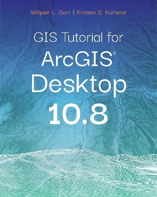
GIS Tutorial for ArcGIS Desktop 10.8
Environmental Systems Research Institute Inc.,U.S. (Verlag)
978-1-58948-614-0 (ISBN)
Updated for use with ArcGIS® Desktop 10.8
GIS Tutorial for ArcGIS Desktop 10.8 is the updated replacement for GIS Tutorial 1: Basic Workbook, 10.3 Edition, a classic textbook for teaching ArcGIS® Desktop.
GIS Tutorial for ArcGIS Desktop 10.8 teaches the fundamentals of using ArcGIS Desktop, the popular professional geographic information systems (GIS) application from Esri. Rooted in the science of geography, GIS is a framework for gathering, managing, and analyzing data using map visualizations and location intelligence. GIS and ArcGIS have become the mainstay of many businesses, organizations, and institutions.
Updated with new images and simplified steps for using the latest version of the software, GIS Tutorial for ArcGIS Desktop 10.8 introduces readers to the tools and functionality of ArcGIS Desktop 10.8. Learn how to use ArcMap and ArcCatalog to make maps, work with spatial data, and analyze spatial data for proximity analysis and site suitability analysis. Gain hands-on experience using ArcGIS 3D Analyst™, ArcGIS Spatial Analyst™, and ArcGIS Network Analyst™ extensions, as well as ArcGIS Online and other software products.
Each chapter is designed from decades of GIS teaching experience by authors Wilpen L. Gorr (ret.) and Kristen S. Kurland, professors at Carnegie Mellon University in Pittsburgh, Pennsylvania. Incorporating proven teaching methods in detailed exercises, "Your Turn" sections, and homework assignments, this book is suited to learning GIS in the classroom or by self-learners. Data for completing the exercises is available for free download.
Renewing a proven standard: GIS Tutorial for ArcGIS Desktop 10.8 helps users explore GIS concepts, apply ArcGIS software, and gain GIS skills, regardless of learning style.
Wilpen L. Gorr is emeritus professor of public policy and management information systems at the School of Public Policy and Management, H. John Heinz III College, Carnegie Mellon University, where he taught and researched GIS applications. He was also chairman of the school’s Master of Science in Public Policy and Management program and editor of the International Journal of Forecasting. Kristen S. Kurland is a Teaching Professor of Architecture, Information Systems, and Public Policy at the H. John Heinz III College and School of Architecture, Carnegie Mellon University, where she teaches GIS, building information modeling, computer-aided design, 3D visualization, infrastructure management, and enterprise data analytics.
Part I: Using and making maps
Chapter 1:Introduction
Chapter 2:Map design
Chapter 3:GIS outputs
Part II: Working with spatial data
Chapter 4:File geodatabases
Chapter 5:Spatial data
Chapter 6:Geoprocessing
Chapter 7:Digitizing
Chapter 8:Geocoding
Part III: Analyzing spatial data
Chapter 9:Spatial analysis
Chapter 10:ArcGIS 3D Analyst
Chapter 11:ArcGIS Spatial Analyst
Chapter 12:ArcGIS Network Analyst
Appendix A: Data credits
| Erscheinungsdatum | 25.08.2021 |
|---|---|
| Reihe/Serie | GIS Tutorial |
| Verlagsort | Redlands |
| Sprache | englisch |
| Maße | 203 x 254 mm |
| Themenwelt | Informatik ► Datenbanken ► Data Warehouse / Data Mining |
| Informatik ► Software Entwicklung ► User Interfaces (HCI) | |
| Naturwissenschaften ► Geowissenschaften ► Geografie / Kartografie | |
| ISBN-10 | 1-58948-614-5 / 1589486145 |
| ISBN-13 | 978-1-58948-614-0 / 9781589486140 |
| Zustand | Neuware |
| Informationen gemäß Produktsicherheitsverordnung (GPSR) | |
| Haben Sie eine Frage zum Produkt? |
aus dem Bereich


