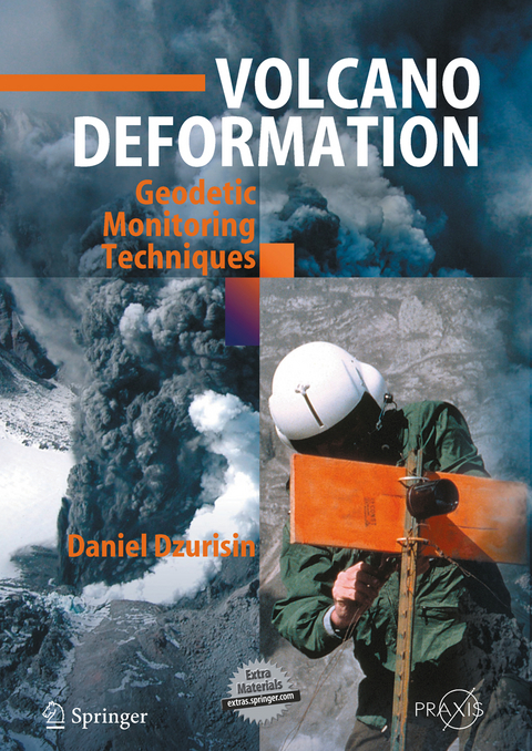
Volcano Deformation
Springer Berlin (Verlag)
978-3-540-42642-4 (ISBN)
Volcanoes and eruptions are dramatic surface man telemetry and processing, and volcano-deformation ifestations of dynamic processes within the Earth, source models over the past three decades. There has mostly but not exclusively localized along the been a virtual explosion of volcano-geodesy studies boundaries of Earth's relentlessly shifting tectonic and in the modeling and interpretation of ground plates. Anyone who has witnessed volcanic activity deformation data. Nonetheless, other than selective, has to be impressed by the variety and complexity of brief summaries in journal articles and general visible eruptive phenomena. Equally complex, works on volcano-monitoring and hazards mitiga however, if not even more so, are the geophysical, tion (e. g. , UNESCO, 1972; Agnew, 1986; Scarpa geochemical, and hydrothermal processes that occur and Tilling, 1996), a modern, comprehensive treat underground - commonly undetectable by the ment of volcano geodesy and its applications was human senses - before, during, and after eruptions. non-existent, until now. Experience at volcanoes worldwide has shown that, In the mid-1990s, when Daniel Dzurisin (DZ to at volcanoes with adequate instrumental monitor friends and colleagues) was serving as the Scientist ing, nearly all eruptions are preceded and accom in-Charge of the USGS Cascades Volcano Observa panied by measurable changes in the physical and tory (CVO), I first learned of his dream to write a (or) chemical state of the volcanic system. While book on volcano geodesy.
1 The modern volcanologist's tool kit.- 1.1 Volcanoes in motion - when deformation gets extreme.- 1.2 Volcanology in the information age.- 1.3 A brief survey of volcano-monitoring techniques.- 1.4 An introduction to geodetic sensors and techniques.- 2 Classical surveying techniques.- 2.1 Early geodetic surveys.- 2.2 Reference systems and datums.- 2.3 Geodetic networks.- 2.4 Trilateration and triangulation.- 2.5 Leveling and tilt-leveling surveys.- 2.6 Photogrammetry.- 2.7 Microgravity surveys.- 2.8 Magnetic field measurements.- 3 Continuous monitoring with in situ sensors.- 3.1 Seismometers.- 3.2 Tiltmeters.- 3.3 Strainmeters.- 3.4 Continuous GPS.- 3.5 Some cautions about near-surface deformation sensors.- 3.6 Continuous gravimeters.- 3.7 Differential lake gauging.- 3.8 Concluding remarks.- 4 The Global Positioning System: A multipurpose tool.- 4.1 Global positioning principles.- 4.2 An overview of GPS, GLONASS, and Galileo.- 4.3 GPS signal structure: what do the satellites broadcast?.- 4.4 Observables: what do GPS receivers measure?.- 4.5 Data combinations and differences.- 4.6 Doing the math: turning data into positions.- 4.7 Relative positioning techniques.- 4.8 CGPS networks.- 4.9 Data processing.- 4.10 Looking to the future.- 5 Interferometric synthetic-aperture radar (InSAR).- 5.1 Radar principles and techniques.- 5.2 Principles of SAR interferometry.- 5.3 Examples of interferometric SAR applied to volcanoes.- 6 Photogrammetry.- 6.1 Introduction.- 6.2 Historical perspective.- 6.3 Photogrammetry fundamentals.- 6.4 Instrumentation and data types.- 6.5 Aerotriangulation.- 6.6 Terrestrial photogrammetry.- 6.7 Application to Mount St. Helens.- 7 Lessons from deforming volcanoes.- 7.1 Mount St. Helens - edifice instability and dome growth.- 7.2 K?lauea volcano, Hawai'i - flank instability and gigantic landslides.- 7.3 Yellowstone - the ups and downs of a restless caldera.- 7.4 Long Valley Caldera and the Mono-Inyo volcanic chain: two decades of unrest (and still counting?).- 8 Analytical volcano deformation source models.- 8.1 Introduction.- 8.2 The elastic half-space: a first approximation of the Earth.- 8.3 Notation.- 8.4 Surface loads.- 8.5 Point forces, pipes, and spheroidal pressure sources.- 8.6 Dipping point and finite rectangular tension cracks.- 8.7 Gravity change.- 8.8 Relationship between subsurface and surface volume changes.- 8.9 Topographic corrections to modeled deformation.- 8.10 Inversion of source parameters from deformation data.- 9 Borehole observations of continuous strain and fluid pressure.- 9.1 Borehole strainmeter design and capabilities.- 9.2 Groundwater level as a volumetric strain indicator.- 9.3 Processing and analyzing continuous strain and water level data.- 9.4 Volumetric strain fields of idealized volcanic sources.- 9.5 Examples.- 9.6 Summary.- 10 Hydrothermal systems and volcano geochemistry.- 10.1 The hydrologic importance of brittle-plastic phenomena.- 10.2 The brittle-plastic transition.- 10.3 Development of plastic rock around shallow intrusive bodies.- 10.4 Storage of hydrothermal fluid in and movement through plastic rock.- 10.5 Self-sealing at the brittle-plastic interface.- 10.6 Mechanisms for breaching the self-sealed zone and discharge of >400°C fluid into cooler rock.- 10.7 Chemical characteristics of fluids in a sub-volcanic environment.- 10.8 A general model of hydrothermal activity in a sub-volcanic environment.- 10.9 Uplift and subsidence of large silicic calderas.- 10.10 Conclusions.- 11 Challenges and opportunities for the 21st century.- 11.1 The intrusion process: a complicated business.- 11.2 Strengths and weaknesses of geodetic monitoring.- 11.3 Why is volcano deformation such an elusive target?.- 11.4 Capturing volcano deformation in space and time.- 11.5 Pie-in-the-sky volcanology.- 11.6 A bright and challenging future.- References.- DVD with figures and supplementary material.
From the reviews:
"This monumental, first-of-a-kind, up-to-date book on volcano geodesy compiled by Dzurisin ... fills an important gap in the rapidly expanding literature discussing the young science of Volcanology. ... The outstanding list of references offers more than 400 citations; the extra material contains all the book's figures plus an expanded version of analytical source models. ... The chapter authors are eminently qualified, and their book is a marvelous contribution to the highly complex, important, and challenging profession of volcano monitoring. Summing Up: Highly recommended." (T. L. T. Grose, CHOICE, Vol. 44 (11), July, 2007)
From the reviews:"This monumental, first-of-a-kind, up-to-date book on volcano geodesy compiled by Dzurisin … fills an important gap in the rapidly expanding literature discussing the young science of Volcanology. … The outstanding list of references offers more than 400 citations; the extra material contains all the book’s figures plus an expanded version of analytical source models. … The chapter authors are eminently qualified, and their book is a marvelous contribution to the highly complex, important, and challenging profession of volcano monitoring. Summing Up: Highly recommended." (T. L. T. Grose, CHOICE, Vol. 44 (11), July, 2007)
| Erscheint lt. Verlag | 14.9.2006 |
|---|---|
| Reihe/Serie | Geophysical Sciences | Springer Praxis Books |
| Zusatzinfo | XXXVI, 442 p. 30 illus. With online files/update. |
| Verlagsort | Berlin |
| Sprache | englisch |
| Maße | 193 x 270 mm |
| Gewicht | 1375 g |
| Themenwelt | Naturwissenschaften ► Geowissenschaften ► Geologie |
| Naturwissenschaften ► Geowissenschaften ► Geophysik | |
| Schlagworte | Borehole • Environment • Formation • Geophysics • Global positioning system (GPS) • GPS (Global Positioning System) • groundwater • Inversion • Monitoring • Networks • Radar principles • Seismology • stability • Synthetic aperture radar interferometry • uplift • volcano • Vulkane |
| ISBN-10 | 3-540-42642-6 / 3540426426 |
| ISBN-13 | 978-3-540-42642-4 / 9783540426424 |
| Zustand | Neuware |
| Haben Sie eine Frage zum Produkt? |
aus dem Bereich


