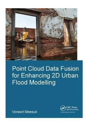
Point Cloud Data Fusion for Enhancing 2D Urban Flood Modelling
CRC Press (Verlag)
978-1-138-37362-4 (ISBN)
This research explores present-day capabilities of using computer-based environments to merge side-view Structure-from-Motion data acquisition with top-view LiDAR data to create a novel multi-source views (MSV) topographic representation for enhancing 2D model schematizations. A new MSV topographic data environment was explored for the city of Delft and compared with the conventional top-view LiDAR approach. Based on the experience gained, the effects of different topographic descriptions were explored for 2D urban flood models of (i) Kuala Lumpur, Malaysia for the 2003 flood event; and (ii) Ayutthaya, Thailand for the 2011 flood event.
It was observed that adopting the new MSV data as the basis for describing the urban topography, the numerical simulations provide a more realistic representation of complex urban flood dynamics, thus enhancing conventional approaches and revealing specific features like flood watermarks identification and helping to develop improved flood-protection measures.
Vorawit Meesuk is a PhD candidate in hydroinformatics for urban flood modelling at UNESCO-IHE and TU-Delft, the Netherlands. He holds a background MSc degree in Remote Sensing and GIS technologies (2003) from Khon Kaen University, Thailand. His PhD research focuses on the topic of applying computer vision and photogrammetry techniques to create better topographical data by merging different sources and difference viewpoints to enhance 2D flood simulation for complex urban cities. Besides doing research, he organised the Ayutthaya workshop in a joint effort with ADB, UNESCO-BANGKOK, in 2014. He also guided MSc students and gave GIS and coupled 1D-2D modelling lectures at UNESCO-IHE. Currently, he works at (HAII/MOST) as a Head of Observation and Telemetry Section, whose responsibilities are to provide and maintain telemetry systems for monitoring weather conditions and water-level changes in over 700 stations in Thailand and neighbouring countries.
1 Introduction
2 State of the art in urban flood modelling
3 Conventional top-view LiDAR topographic data
4 Introducing new side-view SfM topographic data
5 A novel approach for merging multi-views topographic data
6 Applying multi-source views DEM to enhance 2D urban flood simulation: a case study of Kuala Lumpur, Malaysia
7 Extracting inundation patterns from flood watermarks: a case study of Ayutthaya, Thailand
8 Recommendations for developing flood-protection measures: a case study of Ayutthaya, Thailand
9 Outlook of multi-view surveys for urban flood simulation enhancements
10 Conclusions and recommendations
| Erscheinungsdatum | 21.01.2019 |
|---|---|
| Reihe/Serie | IHE Delft PhD Thesis Series |
| Verlagsort | London |
| Sprache | englisch |
| Maße | 174 x 246 mm |
| Gewicht | 453 g |
| Themenwelt | Naturwissenschaften ► Geowissenschaften ► Hydrologie / Ozeanografie |
| Technik ► Bauwesen | |
| ISBN-10 | 1-138-37362-1 / 1138373621 |
| ISBN-13 | 978-1-138-37362-4 / 9781138373624 |
| Zustand | Neuware |
| Informationen gemäß Produktsicherheitsverordnung (GPSR) | |
| Haben Sie eine Frage zum Produkt? |
aus dem Bereich


