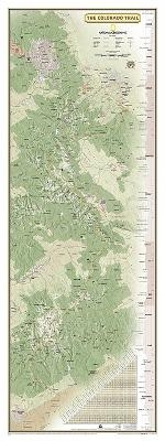
National Geographic Colorado Trail Laminated Wall Map
Seiten
2018
|
2017th ed.
National Geographic Maps (Verlag)
978-1-56695-744-1 (ISBN)
National Geographic Maps (Verlag)
978-1-56695-744-1 (ISBN)
National Geographic's map of the Colorado Trail is ideal for fans and hikers of Colorado's premier long distance trail. It makes a great planning tool or as reference to track progress on the almost 500 mile trail. This beautiful map shows the entire length of the trail from Durango to Denver as it passes along the ridge of the Rocky Mountains. A unique elevation profile highlights the trail's peaks and valleys, and an informative mileage chart shows the distance between key locations. Also highlighted on this map are passes, peaks, national forests, national parks, state parks, and Indian reservations. Additional points of interest include lodges and campgrounds near the trail. The map is encapsulated in heavy-duty 1.6 mil laminate which makes the paper much more durable and resistant to the swelling and shrinking caused by changes in humidity. Laminated maps can be framed without the need for glass, so the fames can be much lighter and less expensive.
| Erscheint lt. Verlag | 15.3.2018 |
|---|---|
| Verlagsort | Evergreen |
| Sprache | englisch |
| Maße | 1219 x 457 mm |
| Themenwelt | Reisen ► Karten / Stadtpläne / Atlanten ► Welt / Arktis / Antarktis |
| Naturwissenschaften ► Geowissenschaften ► Geografie / Kartografie | |
| ISBN-10 | 1-56695-744-3 / 1566957443 |
| ISBN-13 | 978-1-56695-744-1 / 9781566957441 |
| Zustand | Neuware |
| Informationen gemäß Produktsicherheitsverordnung (GPSR) | |
| Haben Sie eine Frage zum Produkt? |
Mehr entdecken
aus dem Bereich
aus dem Bereich
Karte (gerollt) (2024)
Kümmerly+Frey (Verlag)
14,90 €


