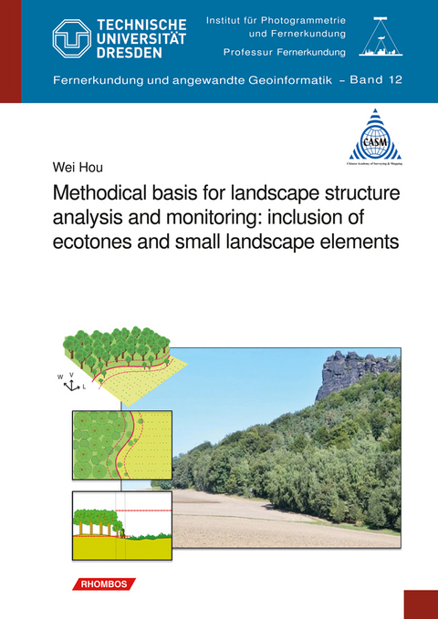
Methodical basis for landscape structure analysis and monitoring: inclusion of ecotones and small landscape elements
Rhombos-Verlag
978-3-944101-21-7 (ISBN)
Methodical basis for landscape structure analysis and monitoring: inclusion of ecotones and small landscape elements
Volume 12 of the series "Remote Sensing and Applied Geoinformatics"
Edited by Univ. Prof. Dr. habil. Elmar Csaplovics, Chair of Remote Sensing, FR Geosciences, TU Dresden
134 pages, DIN B5 format, numerous illustrations, many of them colored. Language: English. Price: 32.80 Euro. ISBN 978-3-944101-21-7. Publisher: Rhombos Verlag, Berlin 2017
A thesis submitted in partial fulfilment of the requirements of the Faculty of Forest, Geo and Hydro Sciences of Technische Universität Dresden for the degree of Doctor of Natural Sciences (Dr.rer.nat.) in 2014
About this book
Effective methods for measuring habitat pattern at landscape level are crucial for understanding the ecological processes. The widely used patch-corridor-matrix model in landscape structure analysis may be oversimplified by losing valuable information, such as the terrain characteristics of landscape, ecotones, and small biotopes. The present work originates from the integration of the third spatial dimension in land-cover classification and landscape structure analysis. The focus is on the extraction of ecotones and small landscape elements based on high-resolution images and DEMs, and the integration of these elements in 3D landscape metrics. This work is meant to supply a possible way to enhance the model of landscape structure analysis. It may be interested to both scientists and practitioners in this field.
Wei Hou (born in 1984) studied Geo-information Science at the China University of Mining and Technology from 2002 to 2009. He has been working as a guest researcher at the Leibniz Institute of Ecological Urban and Regional development in the field of landscape ecology and GIS from 2009 to 2014. Since 2015, he works at the Chinese Academy of Surveying and Mapping (CASM) as research associate. This book was part of his PhD degree of Geoinformatics from the Dresden University of Technology in 2014.
Beruf: Prof. Dr. techn. habil. Elmar Csaplovics leitet den Lehrstuhl Geofernerkundung am Institut für Photogrammetrie und Fernerkundung Angaben zur Person: Prof. Dr. techn. habil. Elmar Csaplovics leitet den Lehrstuhl Geofernerkundung am Institut für Photogrammetrie und Fernerkundung der Technischen Universiaet Dresden Senior Fellow Field of Activities: Remote Sensing for Multi-Scale Environmental Monitoring, Geographical Information Analysis for Multi-Scale Environmental Monitoring, Landcover Change Detection Desertification Monitoring, Digital Terrain Modelling, Tropical Deforestation Mapping Appropriate Technologies in Remote Sensing and GIS, Transnational Networking with Spatial Information Systems. Field of Expertises Education (academic);Geographic Information;Geographical information systems (GIS);Remote Sensing Research Topics Environmental Monitoring;Geographical information analysis for multi-scale environmental monitoring
Contents
1Introduction1
1.1Starting point of this work: biodiversity on landscape level1
1.2Modern landscape ecology and its shortcomings2
1.3Research objectives and key questions3
1.3.1Research objectives3
1.3.2Key questions4
2Theoretical basis and background5
2.1Small biotopes and ecotones as components of landscape pattern5
2.1.1Landscape fragmentation as a result of disappearing small biotopes5
2.1.2A “soft” boundary: ecotones as transitional area between habitats6
2.1.2.1The model of patch boundary7
2.1.2.2The ecotone concept8
2.1.3Ecological functions of small biotopes and ecotones9
2.1.3.1Ecological functions of small biotopes9
2.1.3.2Ecological functions of ecotones11
2.2Landscape monitoring in Germany and China14
2.2.1Landscape monitoring in Germany14
2.2.1.1Current situation of biological diversity in Germany15
2.2.1.2Data used for landscape monitoring16
2.2.1.3Landscape indicators for biodiversity conservation17
2.2.2Landscape monitoring in China20
2.2.2.1Current situation of biological diversity in China20
2.2.2.2Data used for landscape monitoring20
2.2.2.3Landscape indicators for biodiversity conservation21
2.3Summary23
3An enhanced approach for landscape structure analysis25
3.1Data basis25
3.1.1RapidEye images25
3.1.2High resolution elevation data27
3.1.3Other data29
3.2Mapping landscape pattern by integration of an object- and pixel-based classification approach29
3.2.1Object-based image analysis (OBIA): land-use classification based on multi-temporal RapidEye images29
3.2.1.1Spectral feature of RapidEye image30
3.2.1.2Class hierarchy34
3.2.1.3The concept of image segmentation35
3.2.1.4Segmentation and classification strategy36
3.2.2Pixel-based image analysis: detection of ecotones and small biotopes using high resolution NDSM data37
3.2.2.1Ecotone model and definition of small biotopes38
3.2.2.2Applied features and algorithms39
3.2.2.3Detailed landscape structure detection based on NDSM41
3.3Landscape structures analysis43
3.3.1Metrics for describing landscape structure43
3.3.1.1Landscape diversity44
3.3.1.2Landscape fragmentation45
3.3.1.3Landscape contrast46
3.3.2Habitat connectivity analysis considering small biotopes as stepping stones48
3.3.2.1Mapping ecological network49
3.3.2.2Indicators for assessing ecological networks51
3.4Summary52
4Examples of use and results: application of the proposed methodology in test sites of Germany and China53
4.1Study areas and data basis53
4.2Object-based image classification55
4.2.1Classification of main classes55
4.2.1.1Settlement and traffic extraction55
4.2.1.2Assessing scale parameter for segmentation56
4.2.1.3Classification process58
4.2.2Further classification of detailed land-cover classes59
4.2.2.1Detailed classification within settlements59
4.2.2.2Farmland plots delineation60
4.2.2.3Detailed classification within forests61
4.2.3Accuracy assessment63
4.2.3.1Classification accuracy in test site Rathen63
4.2.3.2Classification accuracy in test site Jiawang65
4.3Fine-scale landscape structure detection66
4.3.1Detection results66
4.3.2Accuracy assessment68
4.4Landscape structure analysis69
4.4.1Comparing “2D” and “3D” metrics in practice70
4.4.1.1Basic patch geometry70
4.4.1.2Diversity metrics71
4.4.1.3Effective mesh size (MESH)71
4.4.2Landscape contrast analysis72
4.4.3Ecological network analysis using small biotopes as stepping stones75
4.4.3.1Selection of buffer ranges75
4.4.3.2Mapping ecological networks75
4.4.3.3Analysis of connectivity for the test sites77
4.5Summary78
5Discussion and evaluation79
5.1Evaluation of the proposed methods for image processing79
5.1.1Applying Object-Based Image Analysis (OBIA) on RapidEye data79
5.1.2Applying pixel-based object detection on high resolution NDSM82
5.2Evaluation of the metrics for landscape structure analysis85
5.2.1The application of landscape diversity metrics85
5.2.2The application of the metrics for describing landscape fragmentation/connectivity85
5.2.2.1Unification of landscape fragmentation and connectivity86
5.2.2.2Functional roles of ecotones and small biotopes in econets86
5.2.2.3General applicability in econets analysis87
5.2.3The application of the metrics for describing landscape contrast89
5.3Possible fields of application90
6Conclusion and outlook93
7References99
Foreword
The now printed thesis of Mr. Wei Hou, which originated in the period of his stay at the
Leibniz Institute of Ecological and Regional Development, deals with advanced methods of landscape structure analysis and remote sensing for landscape monitoring. Background is a widespread approach in landscape ecology, according to which the landscape structure or, in other words, the "pattern" or "mosaic" of a landscape arises from the composition and arrangement of discrete patches, e.g. Individual land use units.
These spatial patterns can be quantified using "landscape metrics". The goal is to capture the structure of a landscape, to document it for the purpose of monitoring, or to provide it as input parameters for landscape ecological simulation models. Up to now, however, landscape metrics have mostly deviated from concrete landscape elements. Ecologically important transitional areas between such elements, e.g. height differences, have so far been not or hardly included. In addition, small-scale elements such as individual trees, shrubs, hedges, etc. are also important for a landscape monitoring, but these often do not show up in existing data. The work begins on these two points. The objectives of the work were:
* Development of a model and corresponding methods for the detection of small
landscape elements or biotopes as well as transitional areas between different land uses (ecotones) from remote sensing data and a high-resolution digital surface model.
* Integration of the small-scale landscape elements and ecotones into the methods of landscape structure analysis by adapting or extending existing methods and indices of landscape structure analysis.
For his work, he used data from the satellite “RapidEye” and high-resolution elevation
data from airborne laser scanning. He subsequently developed a multi-level approach in which small-scale landscape elements can be detected using common image processing and GIS software. Furthermore, transitional areas between different land use classes, here mainly between forest and open land, can be characterized. Afterwards, methods for analyzing the landscape structure are presented on this basis. Specially developed indices allow the analysis of landscape diversity, fragmentation, landscape contrasts and biotope networks. Both for complex methods for the detection of small- scale elements and ecotones, as well as for the methods of landscape structure analysis, own algorithms and indices were developed. The developed methods were tested in study areas in Germany and China and their behavior in different landscapes and with different data bases were examined.
Mr. Hou has made a significant contribution to the progress of this research area - even in the international context - with the doctoral thesis he has presented. The innovative approaches, which he developed and exemplarily prepared, testify to this. Beyond that, the work also shows the necessity and also possibilities for application in landscape monitoring. We are confident, that the methods developed by him will find interest and application in science and practice.
Ulrich Walz
Editorial When the term landscape emerged in the 16th century it was coined by the perception of nature in its holistic appearance, i.e. of the wholeness of the visible nature more or less shaped by a location- and time-dependent mixture of anthropozoogenic impact. The “scenery” comprising all the visible elements of a landscape was understood as an aesthetic impression of ostensibly harmonious patterns of a composition of organic and anorganic objects. Accordingly, it was through the fine arts, that by the painting of landscapes the term per se was invented during the late Renaissance (Gombrich 1966). Only during the late 18th and early 19th century the term was scientified by natural scientists such as Alexander von Humboldt, who nevertheless still relied to the (aesthetic) holistic concept of landscape, but at the same time tried to set up a categorisation of the types of elements which “construct” it (Humboldt 1849). Efforts were made to define landscape as a quantifiable multi-layer and multi-scale structure which is solely characterised by specific landscape elements which form ecotopes (“landscape cells”). The mosaic-like concinnity of ecotopes creates the landscape which is experienced as a consistent entity (Troll 1939). Modern landscape ecology understands landscape as a heterogeneous area, which is coined by an aggregate of land forms or an association of habitats and which may comprise an area from some hectares up to hundreds of square kilometres (Turner et Gardner 1991). Three characteristics describing the typology of landscape are generally stressed, explicitly structure, function and change. Structure refers to relations of ecosystems in terms of shape, extent, abundance and configuration of components. Function relies to interactions of elements in space and time, i.e. flows of energy, material or organisms. Change describes the dynamics of structures and functions in a spatio-temporal context (Forman et Godron 1986). Referring to structural characteristics it is obvious that the well-introduced patch-corridor-matrix-model is of limited reliability when extending the approach towards relief information, i.e. the third dimension in terrain description (digital surface/terrain models) as well as when integrating transition zones or gradients between patches. These ecotones have a significant temporal dimension in terms of dynamics of change and have thus a strong influence on parameters describing interrelated ecosystems. Improved approaches to a three-dimensional assessment and analysis of ecological gradients have to take into account that transition between ecological, geographical and environmental entities is generally non-discrete, often fuzzy. This aspect does not only concern relations between landscape elements and land use and land cover categories (describable by fuzzy logics) but also variations of approaches of analysis at multi-scale levels up to the dispersion of populations in respective areas of distribution. An ecological gradient can be described statistically by the fact that the variance of the relevant parameter increases with growing distance from the reference area (landscape element, habitat). It has nonetheless to be asked what would happen if that proportion were affected by diffuse impacts, which cannot be expressed by discontinuities in relief (e.g. in terms of canopy surface gradients from forest edges to adjacent copses and to grassland or agricultural land), such as environmental (human) impact varying locally both in time as well as in space, e.g. imission via air pollution or disturbances by tourism. Advanced technologies of 3D-topographic data acquisition such as Airborne Laser Scanning (ALS) as well as object-oriented approaches of remotely sensed image analysis (OBIA) allow for detection and mapping at very high geometric (spatial) accuracies. Thus, both relief gradients related to ecotones and also to small landscape elements (biotopes inside habitats) can be described in much more detailedness (e.g. Stumberg et al. 2014). It is worthwhile to take advantage of these data qualities and to focus on research into the integration of 3D-structural characteristics of ecotones via enhancing indices such as landscape diversity, fragmentation/connectivity and contrast. One of the core problems in quantitative landscape ecology refers to the question to what extent landscape metrics are capable to assess information which supports the description of species richness (biodiversity?). Obviously, the integration of fine-scale landscape elements (small biotopes) and of ecotones into enhanced landscape metrics paves a way towards a better understanding and a more reliable interpretability and assessability of diversity, connectivity and contrast in landscapes. Gradient analysis along vegetation boundaries (edges) carries a load of further potential of information which needs to be integrated with more sophisticated landscape models to be developed. The extended potential of integration of any kind of gradient-type spatio-temporal information of environmental variables such as temperature, humidity and similar can be investigated. Wei Hou has provided a very important contribution to pushing forward efforts of enhancing the real-world validity of landscape metrics by considering multi-scale characteristics of extent and distribution as well as of (canopy surface) gradients of small biotopes and (small) ecotones - smallness being a variable strongly depending on the scale of observation - based on the capability of spatial data to extract fine-scale elements of the landscape. Elmar Csaplovics
| Erscheinungsdatum | 20.07.2017 |
|---|---|
| Zusatzinfo | numerous illustrations, many of them colored |
| Verlagsort | Berlin |
| Sprache | englisch |
| Maße | 170 x 240 mm |
| Gewicht | 280 g |
| Einbandart | geklebt |
| Themenwelt | Naturwissenschaften ► Geowissenschaften ► Geografie / Kartografie |
| Naturwissenschaften ► Geowissenschaften ► Geologie | |
| Schlagworte | ecotone concept • land-cover classification • landscape ecology • landscape monitoring • landscape structure analysis • rapideye |
| ISBN-10 | 3-944101-21-9 / 3944101219 |
| ISBN-13 | 978-3-944101-21-7 / 9783944101217 |
| Zustand | Neuware |
| Haben Sie eine Frage zum Produkt? |
aus dem Bereich


