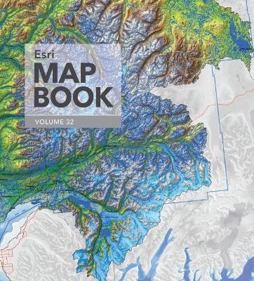
Esri Map Book, Volume 32
ESRI Press (Verlag)
978-1-58948-477-1 (ISBN)
- Titel ist leider vergriffen;
keine Neuauflage - Artikel merken
Every year, works of mapmakers from around the world are selected for the Esri Map Book to demonstrate how geographic information system (GIS) technology helps our governments, businesses, and citizens. Esri Map Book, Volume 32, continues this tradition, showcasing maps and applications that use ArcGIS to evaluate the sustainability of resources, determine efficient transportation routes, mitigate the effects of natural disasters, and much more. Each map or application incudes a description of its purpose and how it was produced. Esri Map Book, Volume 32 is an important collection of maps for GIS users, cartographers, collectors, and map libraries.
Map authors from organizations around the world were selected to contribute to this Esri Map Book. The maps are chosen from submissions displayed at the 2016 Esri International User Conference and other sources. Contributors come from various industries such as conservation, government, natural resources, sustainable development, tourism, and utilities.
Esri Map Book volume 32
Table of Contents
Letter from Jack Dangermond
Business
Goodwill Retail Store Expansion Analysis
The 3D View of Land Prices
New Location Feasibility Study for the Columbus, Ohio, Area
Cartography
Surficial Geology of Morris County, Kansas
Swiss National Map 1:10 000
Horizontal Hachures Map of Diamond Peak, Oregon
Colorado State, Regional, and Local Maps
Hydrographic Mapping of the Matanuska-Susitna Basin in South Central Alaska (back over)
Red Relief Image Map of Mount Usu Volcano
Visualization Tool - Scenario Planning Enhanced with 3D GIS (front cover)
Global Tree Density
Lake Whatcom Watershed
Solar Potential in Kenton County
Conservation and Sustainable Development
Multicriteria Evaluation to Determine Forest Bird Habitat during Spring Migration
Greater Sandpoint Area Greenprint
Marine Munitions Survey
Natura 2000
Education
University of Minnesota Twin Cities Interactive Campus Map
Creating Safe Routes to School with Survey123
University of Maryland Facilities Management
The Geospatial Semester (High School Subsection of Education)
Rerouting the Iditarod
Risk Assessment of Climate-Induced Sea Level Rise in Virginia Beach by 2100
The Effects of Deforestation on the Amazon Rainforest
Environmental Management
Russian River Salmon and Steelhead Monitoring Map
The Environmental Burden Index
Marine Munitions Survey
Government-Law Enforcement
Las Vegas Police Disorder Calls
Government-Public Safety
Tsunami Vulnerability - Crescent City, CA
Bike Aware
Landslide Susceptibility and Element at Risk Assessment
First Creek, Wolverine, and Chelan Complex Wildfire Map
Current Weather & Forecasts App
Arlington Expressway Mobility Corridor
Sidewalk Hazard Data Collection in City of West Jordan
Building Data for Climate Change Adaptation. Filling data gaps and characterizing storm surge impacts in the Hudson River Valley and Long Island
Government-State and Local
GIS at the Office of the Assessor
St. Johns County Residential Building Permits
Tree Canopy Coverage and Change Detection for the City of Avondale Estates, Georgia Between 2009 and 2015
Oxnard Zone Map
Island of Maui, Hawai’I, Parcel Value
Automation of Lithuanian Geodata
European Union Referendum Results (Brexit)
Health and Human Services
North Carolina Low Birth Weight Analysis
County Performance Outcomes By Mental Health Provider Agencies
Built Environment and Asthma in Southern California
Twin Cities Urban Heat Islands and Social Vulnerability
Where Did Our Consumers Go for Vocational Rehabilitation Services?
Health Insurance Coverage
Measuring Area-Based Vulnerability to Gambling-Related Harm
Historical-Cultural
Geostatistical Analysis, Kriging, and Weighted Statistical Modelling for Archaeological Sensitivity in Prehistoric and Historic Context
Humanitarian Affairs
UNICEF: Unless We Act Now
Natural Resources-Agriculture
Crop Migration and Change for Corn, Soybeans, and Spring Wheat
Assessment of a Killer Freeze on Winter Corn in Mexico
Natural Resources-Forestry
Hoover Wilderness Map
Natural Resources-Mining and Earth Sciences
Displaying Electronic Navigational Chart Data in the MACHC
Using GIS for Hydrotechnical Assessment of Riverine Dynamics and Floodplain Hazards
Environmental Sampling at Palmer Station, Antarctica
2016 Kumamoto Earthquake - Measuring Uplift and Depression Using Synthetic Aperture Radar (SAR)
Natural Resources-Petroleum
10 Year Posting Trend for Petroleum and Natural Gas Rights in Northern British Columbia
Natural Resources-Water
Significant Sand Resource Areas in State and Federal Waters Offshore Monmouth County
Planning and Engineering
City of West Linn Street Tree Map
Overhead to Underground: A 3-D GIS Utility Relocation Rendering
Climate-Smart Cities: New York City
Multiple Products One Solution: Ancient Seas to Modern Charts
Air Operations Planning Map Series
3D Building Massing Model for New York City
LASAN: Protecting Public Health and the Environment
City of Scottsdale Hydrant Map
ADWEA Executive Dashboard
Draft Sound Transit 3 package and climate change
Sino-Singapore Tianjin Eco-city
Prague Institute of Planning and Development Maps
Telecommunications
Les Réseaux Covage (The Cable Networks)
Tourism and Recreation
Oregon and Washington Coast Large Print Map
Columbus Metro Bike Map
Desolation Wilderness Trip Planning
Wrangell Forest Visitor Map
City of Bellingham Bike Map
Palestine Tourist City Maps
Transportation
Visualization of Origin-Destination Flow
Roads of Texas Basemap
Aviation in the United States
GIS-Based Investment Management Systems
VTrans Bicycle Corridor Priority
San Francisco International Airport Basemap
Utilities-Electric and Gas
Digitized Power Networks and the Road Ahead
Project NOKOGI: A New Conception of GIS
Utilities-Water and Wastewater
Modeling Overland Flow in a Landscape with Forest Roads
El Segundo Scalable Water Atlas Project
Using GIS to Assist Sewer Authority Infrastructure Management
Major Water, Wastewater, and Reclaim Water Facilities for St. Johns County
Wellhead Protection in Mesa
Joint Outfall System Sewer Analysis
Index by Organization -- Esri
| Erscheinungsdatum | 16.08.2017 |
|---|---|
| Reihe/Serie | Esri Map Book |
| Zusatzinfo | 200 illustrations |
| Verlagsort | Redlands |
| Sprache | englisch |
| Maße | 254 x 279 mm |
| Themenwelt | Reisen ► Karten / Stadtpläne / Atlanten ► Welt / Arktis / Antarktis |
| Naturwissenschaften ► Geowissenschaften ► Geografie / Kartografie | |
| ISBN-10 | 1-58948-477-0 / 1589484770 |
| ISBN-13 | 978-1-58948-477-1 / 9781589484771 |
| Zustand | Neuware |
| Informationen gemäß Produktsicherheitsverordnung (GPSR) | |
| Haben Sie eine Frage zum Produkt? |
aus dem Bereich


