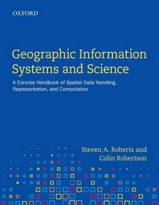
Geographic Information Systems and Science
Oxford University Press, Canada (Verlag)
978-0-19-900363-1 (ISBN)
In order to help students become more effective users of GIS technology, the book highlights many of the common research challenges of GIS and invites the reader to think broadly about the assumptions embedded in GIS practice today. The authors stress a critical approach throughout by describing selected aspects of the field in sufficient depth to scrutinize the formalisms underlying the simple user-interfaces that greet new GIS users. Geographic Information Systems serves as an indispensable gateway to higher study in GIS by readers interested in the fundamental research challenges facing the field today.
Steven A. Roberts is associate professor in the Department of Geography and Environmental Studies at Wilfrid Laurier University and the Director of the Waterloo-Laurier Graduate Program in Geography. Colin Robertson is assistant professor in the Department of Geography and Environmental Studies at Wilfrid Laurier University.
Note: each chapter contains equations and problems.
* Content designed for advanced users
Preface
1. Introduction
1.1 Introduction
1.2 Development of GIS: People and Institutions
1.3 Abstracting and Formalizing Geographic Information
1.3.1 Data Models
1.3.2 Algorithms
1.4 What Is Special about Spatial? *
1.4.1 Spatial vs. Geographic - Patterns and Processes
1.4.2 Time and Geographic Information
2. Geographic Data Acquisition
2.1 Introduction
2.2 Remotely Sensed Data
2.2.1 Aerial Photography
2.2.2 Earth Observation Sensors
2.2.3 Properties of Remotely Sensed Imagery
2.2.4 Handling Remotely Sensed Geographic Data in GIS
2.2.5 Radiometric Processing
2.2.6 Geometric Processing
2.2.7 Remote Sensing Data Compression
2.2.8 Selecting Remotely Sensed Imagery
2.3 Global Positioning Systems
2.3.1 History of GPS Technology
2.3.2 How GPS Works
2.3.3 Handling GPS Data in GIS
2.4 Converting Analogue Geographic Information
2.5 Synthesizing Existing Geographic Information *
2.5.1 Metadata and Geographic Information
2.6 Volunteered Geographic Information *
2.7 UAVs and DIY Geography *
3. Coordinate Systems and Frames of Reference
3.1 Introduction
3.2 Lumpy Ellipsoidal Earth, Flat Maps and Projections
3.3 Datums
3.4 Datum Transformations
3.4.1 Geocentric Datum Transformations
3.4.2 Ellipsoidal Datum Transformations
3.4.3 Grid-based Transformations
3.5 Map Projections and Spatial Reference Systems
3.5.1 Deformation Characteristics
3.5.2 Projected Surface Characteristics
3.5.3 Map Projections Methods
3.6 Scale and Frames of Reference *
4. Geographic Data Models
4.1 Introduction
4.2 Raster
4.2.1 Basic
4.2.2 Geometry
4.2.3 Attributes
4.2.4 Topology
4.2.5 Assumptions
4.2.6 Geometric Processing
4.3 Vector
4.3.1 Basic
4.3.2 Geometry
4.3.3 Attributes
4.3.4 Topology
4.3.5 Assumptions
4.3.6 Geometric Processing
4.4 Dual Vector
4.5 Other Models
4.6 Transforming Between Representations
4.6.1 Raster to Vector and Back
4.6.2 General Transformations *
4.7 Revisiting Standard Models: Topology, Embedding, and Oriented Matroids
4.7.1 Computer Aided Drawing/Drafting/Design (CAD)
4.7.2 Geographic Information Systems (GIS)
4.7.3 Cellular Automata
4.7.4 Oriented Matroids *
5. Geographic Representation and Data Modelling
5.1 Introduction
5.2 Relational Databases and GIS
5.2.1 Emergence of RDBMS in GIS
5.2.2 Entity-Relationship Modelling
5.2.3 Generating Candidate Tables and Database Normalization
5.3 Objects and GIS
5.3.1 Key Concepts in Object Orientation
5.4 Object-Relational Databases
5.5 Database Storage
5.5.1 Data Types
5.6 Database Access and Manipulation
5.6.1 Structured Query Language (SQL)
5.6.2 Procedures, Triggers, and the Like
5.6.3 Spatial Indexing
5.6.4 Geographical Time-Series
5.7 Next-generation Databases for GIS
5.7.1 Document-storage Databases and NoSQL
5.7.2 Crowdsourcing: the Undatabase
6. Geographic Data Editing
6.1 Introduction
6.2 Editing Geographic Data Globally
6.2.1 Linear Transformation
6.2.2 Rubbersheeting
6.2.3 Generalization
6.3 Editing Feature Geometry
6.3.1 Detecting Errors
6.3.2 Fuzzy Tolerance and Snapping Features
6.3.3 Complex Geometry: Island Polygons, Donut Holes, and Measures
6.3.4 Multi-user Editing and Version Control Systems
6.4 Map Conflation
7. Error and Uncertainty in Geographic Information
7.1 Introduction
7.2 Samples and Populations: Statistical Inference in Geographical Analysis
7.3 Geographic Patterns as the Outcome of Stochastic Processes
7.4 Spatial Data Error, Uncertainty, and Spatial Data Quality
7.4.1 Vector Positional Accuracy
7.4.2 Raster Positional accuracy
7.4.3 Attribute Accuracy
7.4.4 Completeness
7.5 Error Propagation in Geographic Analysis
7.6 Fuzzy Geography
7.7 Topological Error
8. GeoComputation
8.1 Introduction
8.2 Algorithms
8.2.1 Line Segment Intersection
8.2.2 Point in Polygon
8.2.3 Convex Hulls
8.2.4 Voronoi Diagrams
8.2.5 Shortest Path Dijkstra's Algorithm
8.3 Computational Issues
8.3.1 Finite Precision Storage and Overflow Errors and Rounding Errors
8.3.2 Supercomputing
9. Geographic Measures
9.1 Introduction
9.2 Scales of Measurement
9.2.1 Nominal
9.2.2 Ordinal
9.2.3 Interval
9.2.4 Ratio
9.3 Central Tendency and Dispersion (1D and 2D)
9.3.1 Central Tendency 1D
9.3.2 Dispersion 1D
9.3.3 Central Tendency 2D
9.3.4 Dispersion 2D
9.4 [Adv] Measuring Geographical Patterns
9.4.1 Point Patterns
9.4.2 Spatial Autocorrelation
9.4.3 Landscape Metrics
10. Geographic Relationships
10.1 Introduction
10.2 Basic Measures of Geographic Relationships and Forms
10.2.1 Distance
10.2.2 Direction
10.2.3 Adjacency
10.2.4 Interaction
10.2.5 Neighbourhood
10.2.6 Area
10.3 Advanced Measures of Geographic Relationships and Forms *
10.3.1 Shape
10.3.2 Dimension
10.3.3 Connectivity Measures for a Connected Planar Graph
11. Geographic Analysis
11.1 Introduction
11.2 The Algebra of Analysis
11.2.1 Boolean Algebra
11.2.2 Map Algebra
11.3 Analyzing Geographical Patterns *
11.3.1 Recognizing and Classifying Geographic Patterns
11.3.2 Generating New Patterns from Existing Geographic Patterns
11.3.3 Extracting Optimal Information from Geographic Patterns
12. Emerging Trends in Geographic Information
12.1 Introduction
12.2 Data Acquisition
12.3 Data Modelling
12.4 GIS Data and Society
Appendix I. Mathematical Notation and Terminology
I.1 Sets
I.2 Summation
I.3 Vectors and Matrices
I.4 Mathematical Expectation
Appendix II. Mathematical Graphs
II.1 Prim's Algorithm for Finding a Minimum Spanning Tree (MST)
II.2 Euler's equation.
Appendix III. Why (n - 1) and not n in s2?
Appendix IV. Details on Information Measure
Appendix V. Rotation Transformation
V.1 The Basic Result
V.2 The Double Angle Formulas
V.3 Sine and Cosine Definit
Appendix VI. Projections and Transformations
VI.1 The Rotational Ellipsoid
VI.2 Ellipsoidal Geographic Coordinates
References
Glossary
Index
| Erscheinungsdatum | 27.10.2016 |
|---|---|
| Zusatzinfo | 17 photos, 210 figures, 36 tables, 13 maps |
| Sprache | englisch |
| Maße | 180 x 229 mm |
| Gewicht | 560 g |
| Themenwelt | Naturwissenschaften ► Geowissenschaften ► Geografie / Kartografie |
| ISBN-10 | 0-19-900363-7 / 0199003637 |
| ISBN-13 | 978-0-19-900363-1 / 9780199003631 |
| Zustand | Neuware |
| Haben Sie eine Frage zum Produkt? |
aus dem Bereich


