


Wrocław/Breslau. Historyczno-topograficzny atlas miast śląskich.
Historisch-topographischer Atlas schlesischer Städte. Tom/Band 5.
Seiten
2016
Verlag Herder-Institut
978-3-87969-410-5 (ISBN)
Verlag Herder-Institut
978-3-87969-410-5 (ISBN)
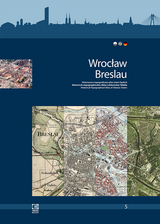
The aim of the atlas, published by the Herder Institute together with Polish and Czech partners, is to present the topographic settlement development of 34 selected towns in the historical region of Silesia from the 19th to the 21st century. In addition to texts on the development of the respective town, the concept of the project also includes the editing of official topographical map sources and aerial photographic sources, some of which are unique, at a uniform scale of 1:25000, from the years around 1830, 1900, 1940, 1975 and 2000.
| Erscheinungsdatum | 20.07.2016 |
|---|---|
| Reihe/Serie | Historisch-topographischer Atlas schlesischer Städte ; 5 |
| Mitarbeit |
Anpassung von: Rafał Eysymontt, Grzegorz Strauchold |
| Verlagsort | Deutschland |
| Sprache | Polish |
| Maße | 297 x 420 mm |
| Gewicht | 840 g |
| Einbandart | geheftet |
| Themenwelt | Reisen ► Karten / Stadtpläne / Atlanten |
| Naturwissenschaften ► Geowissenschaften ► Geografie / Kartografie | |
| Schlagworte | Atlaswerk • Breslau • Edition • Haslinger • Kartenquellen • Kartographie, Kartierung • Kreft • Landkarten und Atlanten • Luftbildquellen • Stadtentwicklung • Strauchold • Topographischer Atlas • Wroclaw • Wrocław |
| ISBN-10 | 3-87969-410-9 / 3879694109 |
| ISBN-13 | 978-3-87969-410-5 / 9783879694105 |
| Zustand | Neuware |
| Haben Sie eine Frage zum Produkt? |
Mehr entdecken
aus dem Bereich


aus dem Bereich
über eine faszinierende Welt zwischen Wasser und Land und warum sie …
Buch | Hardcover (2023)
dtv (Verlag)
24,00 €
Richtlinien für die verkehrsrechtliche Sicherung von Arbeitsstellen …
Buch | Softcover (2022)
Kirschbaum (Verlag)
97,40 €