


![The United States For Kids Map [in Gift Box] - National Geographic Maps](/media/102400807 "Bild vergrößern")
The United States For Kids Map [in Gift Box]
Seiten
2015
|
2015th ed.
National Geographic Maps (Verlag)
978-1-59775-630-3 (ISBN)
National Geographic Maps (Verlag)
978-1-59775-630-3 (ISBN)
- Titel nicht im Sortiment
- Artikel merken
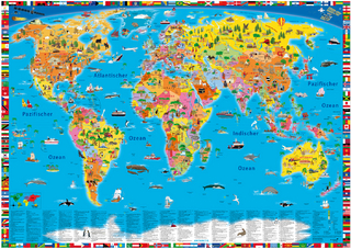
National Geographic's The United States for Kids wall map is an enticing and engaging United States map perfect for classroom, home or library. Recommended by geography educators for ages 7 - 12, this map features an optimized map design for readability and easy, intuitive learning. All 50 states and the District of Columbia are shown with their official, colorful flags, The flags are arranged in alphabetical order for ease-of-use. Expertly researched, The United States for Kids map is an essential reference tool for today's well informed student of geography. The map is packaged in a full color box that is perfect for gift giving. The box includes details about the map with its size and scale as well as a large section of the map that displays the cartography found inside.
| Erscheint lt. Verlag | 30.7.2015 |
|---|---|
| Zusatzinfo | 1 Illustrations, unspecified |
| Verlagsort | Evergreen |
| Sprache | englisch |
| Maße | 610 x 915 mm |
| Themenwelt | Reisen ► Karten / Stadtpläne / Atlanten ► Welt / Arktis / Antarktis |
| Naturwissenschaften ► Geowissenschaften ► Geografie / Kartografie | |
| ISBN-10 | 1-59775-630-X / 159775630X |
| ISBN-13 | 978-1-59775-630-3 / 9781597756303 |
| Zustand | Neuware |
| Informationen gemäß Produktsicherheitsverordnung (GPSR) | |
| Haben Sie eine Frage zum Produkt? |
Mehr entdecken
aus dem Bereich

aus dem Bereich
Karte (plano) (2025)
Freytag-Berndt und ARTARIA (Verlag)
689,90 €